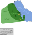
Size of this preview: 560 × 599 pixels. Other resolutions: 224 × 240 pixels | 448 × 480 pixels | 717 × 768 pixels | 957 × 1,024 pixels | 1,913 × 2,048 pixels | 3,737 × 4,000 pixels.
Original file (3,737 × 4,000 pixels, file size: 579 KB, MIME type: image/png)
File history
Click on a date/time to view the file as it appeared at that time.
| Date/Time | Thumbnail | Dimensions | User | Comment | |
|---|---|---|---|---|---|
| current | 04:12, 24 December 2023 |  | 3,737 × 4,000 (579 KB) | عبد العزيز علي | Capitals |
| 04:21, 31 October 2023 |  | 3,743 × 4,000 (564 KB) | عبد العزيز علي | إزالة التشكيل من المصدر | |
| 04:18, 31 October 2023 |  | 3,743 × 4,000 (567 KB) | عبد العزيز علي | Details | |
| 12:29, 22 June 2023 |  | 7,030 × 5,137 (1.05 MB) | عبد العزيز علي | الأحساء | |
| 09:28, 25 May 2023 |  | 6,976 × 5,122 (1.03 MB) | عبد العزيز علي | قطر + أوال أو جزيرة البحرَين + الخليج العربي | |
| 18:11, 29 April 2023 |  | 5,914 × 5,055 (842 KB) | عبد العزيز علي | Uploaded own work with UploadWizard |
File usage
The following page uses this file:
Global file usage
The following other wikis use this file:
- Usage on ar.wikipedia.org
- Usage on ar.wikiquote.org
- Usage on www.wikidata.org

