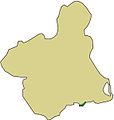
Mapa_localizacion_sierra_fausilla.jpg (571 × 600 pixels, file size: 38 KB, MIME type: image/jpeg)
File history
Click on a date/time to view the file as it appeared at that time.
| Date/Time | Thumbnail | Dimensions | User | Comment | |
|---|---|---|---|---|---|
| current | 17:58, 9 June 2008 |  | 571 × 600 (38 KB) | Nanosanchez | {{Information |Description={{es|1=Mapa de localización del Espacio Protegido Sierra de la Fausilla en Cartagena}} |Source=trabajo propio (own work) |Author=Nanosanchez |Date=09/06/2008 |Permission= |other_versions= }} {{ImageUpload| |
File usage
The following page uses this file:
Global file usage
The following other wikis use this file:
- Usage on es.wikipedia.org
