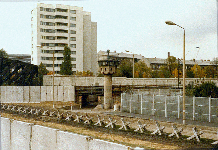
Berliner_Mauer_mit_Panzersperren_(Liesenstraße-Gartenstraße_1980).jpg (717 × 494 pixels, file size: 528 KB, MIME type: image/jpeg)
File history
Click on a date/time to view the file as it appeared at that time.
| Date/Time | Thumbnail | Dimensions | User | Comment | |
|---|---|---|---|---|---|
| current | 15:16, 4 June 2023 |  | 717 × 494 (528 KB) | Hohum | Reworked from original. |
| 15:42, 9 November 2016 |  | 717 × 494 (411 KB) | Axel.Mauruszat | Farben angepasst, Fehlstellen beseitigt | |
| 03:29, 3 August 2005 |  | 717 × 494 (509 KB) | Herr Klugbeisser | Entry point of the West Berlin S-Bahn into East Berlin near the Berlin Wall in Liesenstr./Gartenstr., 1980 S-Bahn-Einfahrt in den Ostsektor: Mauerdreieck Liesenstr./Gartenstr. 1980 * Photographer/Fotograf: Alexander Buschorn (1980) * License/Lizenz: GNU |
File usage
The following page uses this file:
Global file usage
The following other wikis use this file:
- Usage on af.wikipedia.org
- Usage on als.wikipedia.org
- Usage on ar.wikipedia.org
- Usage on ast.wikipedia.org
- Usage on ba.wikipedia.org
- Usage on cs.wikipedia.org
- Usage on da.wikipedia.org
- Usage on de.wikipedia.org
- Berliner Mauer
- Deutsche Wiedervereinigung
- Stadtmauer
- Berlin Nordbahnhof
- Deutsche Teilung
- Portal:DDR
- Deutsche Demokratische Republik
- Kordon (Grenzanlage)
- Portal:Deutschland/Exzellente Artikel
- Liesenstraße
- Tschechenigel
- Liste geteilter Orte
- Liste befestigter Grenzen
- Wikipedia Diskussion:Benutzersperrung/Franz Jäger Berlin
- Benutzer:Platte/Baustelle/Stettiner Bahnhof
- Liesenbrücken
- Usage on el.wikipedia.org
- Usage on eo.wikipedia.org
- Usage on es.wikipedia.org
- Usage on eu.wikipedia.org
- Usage on fi.wikipedia.org
- Usage on fr.wikipedia.org
- Usage on he.wikipedia.org
- Usage on hy.wikipedia.org
- Usage on ia.wikipedia.org
- Usage on ja.wikipedia.org
- Usage on la.wikipedia.org
- Usage on nl.wikipedia.org
- Usage on no.wikipedia.org
View more global usage of this file.

