Size of this preview: 800 × 600 pixels. Other resolutions: 320 × 240 pixels | 640 × 480 pixels | 1,024 × 768 pixels | 1,280 × 960 pixels.
Original file (1,280 × 960 pixels, file size: 1.16 MB, MIME type: image/jpeg)
| This is a file from the Wikimedia Commons. Information from its description page there is shown below. Commons is a freely licensed media file repository. You can help. |
Summary
| Description |
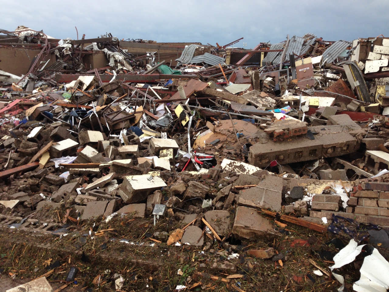
English: 2013 Moore tornado damage at Briarwood Elementary School, EF5 rated by NWS WFO Norman, OK |
| Date | |
| Source | http://arcgis-nwsdatsecurestd-560264031.us-east-1.elb.amazonaws.com/arcgis/rest/services/DamageAssessmentToolkit/DamageFlexViewer/MapServer/0/141947/attachments/98967 from http://www.srh.noaa.gov/images/oun/wxevents/20130520/20130520-storm_survey_path_points.kmz as linked from http://www.srh.noaa.gov/oun/?n=events-20130520 |
| Author | NWS WFO Norman, OK |
| Date of Damage | 05/20/2013 15:48 UTC |
| Date of Survey | 05/21/2013 19:31 UTC |
| EF Rating | EF5 |
| Damage Indicator | Elementary School [Single Story; Interior or Exterior Hallways] (ES) |
| Degree of Damage | Total destruction of a large section of building or entire building |
| Latitude | 35.32133326 |
| Longitude | -97.52087024 |
| Camera location | | View this and other nearby images on: OpenStreetMap |
|---|
This File:NWS_2013_Moore_EF5_damage.jpg photo is explicitly identified as an example of EF5 damage in the NWS's kml file http://www.srh.noaa.gov/images/oun/wxevents/20130520/20130520-storm_survey_path_points.kmz as linked from http://www.srh.noaa.gov/oun/?n=events-20130520 as retrieved on 2013-06-17.
Licensing
This file is in the public domain in the United States because it was solely created by employees of the National Weather Service or National Severe Storms Laboratory using the Damage Assessment Toolkit (DAT), an interactive map and database.
|
File history
Click on a date/time to view the file as it appeared at that time.
| Date/Time | Thumbnail | Dimensions | User | Comment | |
|---|---|---|---|---|---|
| current | 23:30, 22 May 2013 | | 1,280 × 960 (1.16 MB) | Sitic | {{Information |Description ={{en|1=2013 Moore tornado damage at Briarwood Elementary School, EF5 rated by NWS WFO Norman, OK}} |Source =http://arcgis-nwsdatsecurestd-560264031.us-east-1.elb.amazonaws.com/arcgis/rest/services/DamageAssessment... |
File usage
The following pages on the English Wikipedia use this file (pages on other projects are not listed):
Global file usage
The following other wikis use this file:
- Usage on am.wikipedia.org
- Usage on ca.wikipedia.org
- Usage on cs.wikipedia.org
- Usage on da.wikipedia.org
- Usage on de.wikipedia.org
- Usage on gl.wikipedia.org
- Usage on it.wikipedia.org
- Usage on ja.wikipedia.org
- Usage on nl.wikipedia.org
- Usage on ru.wikipedia.org
- Usage on ta.wikipedia.org
- Usage on zh.wikipedia.org