
Size of this preview: 800 × 568 pixels. Other resolutions: 320 × 227 pixels | 640 × 454 pixels | 1,024 × 727 pixels | 1,280 × 909 pixels | 1,518 × 1,078 pixels.
Original file (1,518 × 1,078 pixels, file size: 572 KB, MIME type: image/jpeg)
Summary
edit
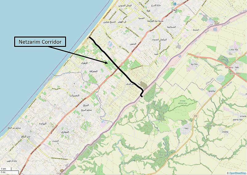
Map of Gaza, highlighting Netzarim Corridor expanded in 2024 during Gaza-Israel War. Sourced from OpenMaps and edited, free use permitted to all with attribution to OpenMaps.
Licensing
edit
I, the copyright holder of this work, hereby publish it under the following license:
| This work is licensed under the Creative Commons Attribution-ShareAlike 4.0 License. |
File history
Click on a date/time to view the file as it appeared at that time.
| Date/Time | Thumbnail | Dimensions | User | Comment | |
|---|---|---|---|---|---|
| current | 01:35, 13 March 2024 | | 1,518 × 1,078 (572 KB) | DRosenbach (talk | contribs) | Map of Gaza, highlighting Netzarim Corridor expanded in 2024 during Gaza-Israel War. Sourced from OpenMaps and edited, free use permitted to all with attribution to OpenMaps. |
You cannot overwrite this file.
File usage
The following pages on the English Wikipedia use this file (pages on other projects are not listed):