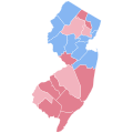
Size of this PNG preview of this SVG file: 600 × 600 pixels. Other resolutions: 240 × 240 pixels | 480 × 480 pixels | 768 × 768 pixels | 1,024 × 1,024 pixels | 2,048 × 2,048 pixels | 810 × 810 pixels.
Original file (SVG file, nominally 810 × 810 pixels, file size: 31 KB)
File history
Click on a date/time to view the file as it appeared at that time.
| Date/Time | Thumbnail | Dimensions | User | Comment | |
|---|---|---|---|---|---|
| current | 20:24, 28 March 2024 |  | 810 × 810 (31 KB) | ZackCarns | Map shapes |
| 04:43, 16 November 2021 |  | 369 × 687 (72 KB) | Pentock | Undoing vandalism by a vandal account. Reverted to version as of 16:35, 30 June 2021 (UTC) | |
| 20:59, 30 June 2021 |  | 369 × 687 (9 KB) | TylerKutschbach | Reverted to version as of 09:25, 27 June 2021 (UTC) | |
| 16:35, 30 June 2021 |  | 369 × 687 (72 KB) | Pentock | Reverted to version as of 23:41, 31 January 2021 (UTC). This map more accurately reflects county lines. | |
| 09:25, 27 June 2021 |  | 369 × 687 (9 KB) | Putitonamap98 | lines | |
| 23:41, 31 January 2021 |  | 369 × 687 (72 KB) | TylerKutschbach | Uploaded own work with UploadWizard |
File usage
The following page uses this file:
Global file usage
The following other wikis use this file:
- Usage on ko.wikipedia.org