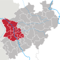
Size of this PNG preview of this SVG file: 600 × 600 pixels. Other resolutions: 240 × 240 pixels | 480 × 480 pixels | 768 × 768 pixels | 1,024 × 1,024 pixels | 2,048 × 2,048 pixels | 660 × 660 pixels.
Original file (SVG file, nominally 660 × 660 pixels, file size: 221 KB)
File history
Click on a date/time to view the file as it appeared at that time.
| Date/Time | Thumbnail | Dimensions | User | Comment | |
|---|---|---|---|---|---|
| current | 15:34, 20 October 2009 |  | 660 × 660 (221 KB) | TUBS | -AC |
| 08:03, 4 November 2008 |  | 660 × 660 (223 KB) | TUBS | {{Information |Description= |Source= |Date= |Author= |Permission= |other_versions= }} | |
| 15:12, 25 September 2008 |  | 660 × 660 (221 KB) | TUBS | == Summary == {{Information |Description=Map of Regierungsbezirk Düsseldorf, a Governmental District of Northrhine-Westphalia (NRW), Germany. |Source=Based upon template: <imagemap> image:North rhine w template 2.png|100px| default [[:Image: |
File usage
The following page uses this file:
Global file usage
The following other wikis use this file:
- Usage on an.wikipedia.org
- Usage on ar.wikipedia.org
- Usage on be.wikipedia.org
- Usage on ckb.wikipedia.org
- Usage on de.wikipedia.org
- Regierungsbezirk Düsseldorf
- Kommunalwahlen in Nordrhein-Westfalen 2009
- Diskussion:Kommunalwahlen in Nordrhein-Westfalen 2009
- Regierungsbezirke in Nordrhein-Westfalen
- Vorlage:Navigationsleiste Vogelschutzgebiete im Regierungsbezirk Düsseldorf
- Unterer Niederrhein
- Schwalm-Nette-Platte mit Grenzwald und Meinweg
- Usage on el.wikipedia.org
- Usage on eo.wikipedia.org
- Usage on es.wikipedia.org
- Usage on et.wikipedia.org
- Usage on frr.wikipedia.org
- Usage on hu.wikipedia.org
- Usage on ia.wikipedia.org
- Usage on li.wikipedia.org
- Usage on nl.wikipedia.org
- Usage on os.wikipedia.org
- Usage on pt.wikipedia.org
- Usage on ru.wikipedia.org
- Usage on www.wikidata.org

