Size of this preview: 586 × 599 pixels. Other resolutions: 235 × 240 pixels | 470 × 480 pixels | 751 × 768 pixels | 1,218 × 1,245 pixels.
Original file (1,218 × 1,245 pixels, file size: 52 KB, MIME type: image/png)
File history
Click on a date/time to view the file as it appeared at that time.
| Date/Time | Thumbnail | Dimensions | User | Comment | |
|---|---|---|---|---|---|
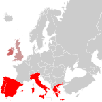
| current | 19:24, 29 March 2010 |  | 1,218 × 1,245 (52 KB) | Pruxo | {{Information |Description={{en|== Licensing: ==}} map of PIGS countrys, with EIRE |Source=*File:PIGSmap.png |Date=2010-03-29 18:54 (UTC) |Author=*File:PIGSmap.png: Original uploader was Gav235 at [http://en.wikipedia.org e |
| 12:10, 11 February 2010 |  | 1,218 × 1,245 (78 KB) | Cantons-de-l'Est | {{Information |Description={{en|== Licensing: ==}} |Source=Transferred from [http://en.wikipedia.org en.wikipedia] |Date={{Date|2009|06|17}} (first version); {{Date|2009|06|17}} (last version) |Author=Original uploader was Gav235 at [h |
File usage
No pages on the English Wikipedia use this file (pages on other projects are not listed).

