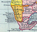
Penguin_Islands_on_1897_map.jpg (524 × 455 pixels, file size: 156 KB, MIME type: image/jpeg)
File history
Click on a date/time to view the file as it appeared at that time.
| Date/Time | Thumbnail | Dimensions | User | Comment | |
|---|---|---|---|---|---|
| current | 10:20, 1 November 2013 |  | 524 × 455 (156 KB) | Philafrenzy | {{Information |Description ={{en|1=The Penguin Islands on an extract from a map of colonial Africa in the 1897 Gardiner's School Atlas of English History.}} |Source =Scan of original |Author =Gardiner's School Atlas of English Histor... |
File usage
The following 2 pages use this file:
Global file usage
The following other wikis use this file:
- Usage on cs.wikipedia.org
- Usage on eo.wikipedia.org
- Usage on id.wikipedia.org
- Usage on sv.wikipedia.org
- Usage on ur.wikipedia.org
- Usage on vi.wikipedia.org
