File:Perseus A High Altitude Remotely Piloted Aircraft being Towed in Flight.jpg

Original file (2,770 × 2,071 pixels, file size: 4.5 MB, MIME type: image/jpeg)

Summary

Description
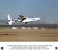
English: Perseus A, a remotely piloted, high-altitude research vehicle designed by Aurora Flight Sciences Corp., takes off from Rogers Dry Lake at the Dryden Flight Research Center, Edwards, California. The Perseus was towed into the air by a ground vehicle. At about 700 ft. the aircraft was released and the engine turned the propeller to take the plane to its desired altitude.
Date Taken on 23 February 1994
Source http://www.dfrc.nasa.gov/Gallery/Photo/Perseus/HTML/EC94-42461-2.html
Author NASA/DFRC/Jim Bean
This image or video was catalogued by Armstrong Flight Research Center of the United States National Aeronautics and Space Administration (NASA) under Photo ID: EC94-42461-2.

This tag does not indicate the copyright status of the attached work. A normal copyright tag is still required. See Commons:Licensing.
Other languages:

Licensing

Public domain This file is in the public domain in the United States because it was solely created by NASA. NASA copyright policy states that "NASA material is not protected by copyright unless noted". (See Template:PD-USGov, NASA copyright policy page or JPL Image Use Policy.)
Warnings:

Captions

Add a one-line explanation of what this file represents

Items portrayed in this file

depicts

File history

Click on a date/time to view the file as it appeared at that time.

Date/TimeThumbnailDimensionsUserComment
current15:17, 10 March 2013Thumbnail for version as of 15:17, 10 March 20132,770 × 2,071 (4.5 MB)HuntsterCrop from original image source to remove text.
03:23, 29 August 2012Thumbnail for version as of 03:23, 29 August 20121,536 × 1,321 (271 KB)Stobkcuf== {{int:filedesc}} == {{Information |Description='''Collection:''' NASA Image eXchange Collection '''Title:''' Perseus A High Altitude Remotely Piloted Aircraft being Towed in Flight '''Description:''' Perseus A, a remotely piloted, high-altitude res...

The following page uses this file: