Size of this preview: 579 × 599 pixels. Other resolutions: 232 × 240 pixels | 464 × 480 pixels | 742 × 768 pixels | 989 × 1,024 pixels | 1,979 × 2,048 pixels | 8,695 × 9,000 pixels.
Original file (8,695 × 9,000 pixels, file size: 12.16 MB, MIME type: image/jpeg)
| This is a file from the Wikimedia Commons. Information from its description page there is shown below. Commons is a freely licensed media file repository. You can help. |
Summary
This file was uploaded by the Digital Public Library of America, and the following item metadata was created by the contributing institution's staff.
Note: this data is being maintained by an automated bot, synced with the source data.
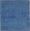
| DescriptionPlat of Barnum - DPLA - 8a432735b6fa9dcbfe14c8c55c75e2ce.jpg | Blueprint map showing boundaries of plots, land owners for larger areas, stret names, and neighborhood additions. | ||||||||||||||||||||
| Title
InfoField | Plat of Barnum | ||||||||||||||||||||
| Institution
InfoField |
institution QS:P195,Q69470198 |
||||||||||||||||||||
| Subject
InfoField | |||||||||||||||||||||
| Source |
Plains to Peaks Collective |
||||||||||||||||||||
| Author |
This file is lacking author information.
|
||||||||||||||||||||
| Permission (Reusing this file) |
Copyright determination made by Denver Public Library (Q69470198) using RightsStatements.org
|
||||||||||||||||||||
| Partnership
InfoField |
|
||||||||||||||||||||
Captions
Add a one-line explanation of what this file represents
Items portrayed in this file
depicts
Plat of Barnum (English)
Reference
Reference
Reference
Reference
Blueprint map showing boundaries of plots, land owners for larger areas, stret names, and neighborhood additions. (English)
image/jpeg
File history
Click on a date/time to view the file as it appeared at that time.
| Date/Time | Thumbnail | Dimensions | User | Comment | |
|---|---|---|---|---|---|
| current | 13:55, 18 December 2020 |  | 8,695 × 9,000 (12.16 MB) | DPLA bot | Uploading DPLA ID 8a432735b6fa9dcbfe14c8c55c75e2ce |
File usage
The following page uses this file:


