Original file (SVG file, nominally 959 × 593 pixels, file size: 84 KB)
| This is a file from the Wikimedia Commons. Information from its description page there is shown below. Commons is a freely licensed media file repository. You can help. |
Summary

|
This file may be updated to reflect new information. If you wish to use a specific version of the file without it being overwritten, please upload the required version as a separate file. |
| DescriptionPolling map for the 2016 Democratic primaries.svg |
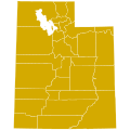
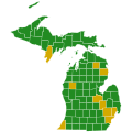
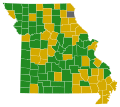
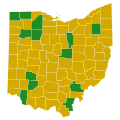
English: A map showing Democratic candidates leading in polls for President by state.*
10 states & D.C. *Please note that some states have polls with margin of errors that may not be reflected accurately on this map. |
||||||
| Date | |||||||
| Source | Own work | ||||||
| Author | Prcc27 | ||||||
| Other versions |
[edit]
|
||||||
| SVG development InfoField |

|
This file may be updated to reflect new information. If you wish to use a specific version of the file without it being overwritten, please upload the required version as a separate file. |
Licensing
- You are free:
- to share – to copy, distribute and transmit the work
- to remix – to adapt the work
- Under the following conditions:
- attribution – You must give appropriate credit, provide a link to the license, and indicate if changes were made. You may do so in any reasonable manner, but not in any way that suggests the licensor endorses you or your use.
- share alike – If you remix, transform, or build upon the material, you must distribute your contributions under the same or compatible license as the original.
| Annotations InfoField | This image is annotated: View the annotations at Commons |
The Iowa caucuses have already been completed.
The New Hampshire primary has already been completed.
The Nevada caucuses have already been completed.
The South Carolina primary has already been completed.
The Alabama primary has already been completed.
The Arkansas primary has already been completed.
The Colorado caucuses have already been completed.
The Georgia primary has already been completed.
The Massachusetts primary has already been completed.
The Minnesota caucuses have already been completed.
The Oklahoma primary has already been completed.
The Tennessee primary has already been completed.
The Vermont primary has already been completed.
The Louisiana primary has already been completed.
The Nebraska caucuses have already been completed.
The Kansas caucuses have already been completed.
The Maine caucuses have already been completed.
The Texas primary has already been completed.
The Mississippi primary has already been completed.
The Michigan primary has already been completed.
The Missouri primary has already been completed.
The Illinois primary has already been completed.
The Ohio primary has already been completed.
The North Carolina primary has already been completed.
The Florida primary has already been completed.
The Arizona primary has already been completed.
The Utah caucuses have already been completed.
The Idaho caucuses have already been completed.
The Wisconsin primary has already been completed.
The Washington caucuses have already been completed.
The Wyoming caucuses have already been completed.
The Alaska caucuses have already been completed.
The Hawaii caucuses have already been completed.
The New York primary has already been completed.
The Indiana primary has already been completed.
The Maryland primary has already been completed.
The Pennsylvania primary has already been completed.
The Delaware primary has already been completed.
The Connecticut primary has already been completed.
The Rhode Island primary has already been completed.
The Virginia primary has already been completed.
Captions
Items portrayed in this file
depicts
29 July 2015
File history
Click on a date/time to view the file as it appeared at that time.
| Date/Time | Thumbnail | Dimensions | User | Comment | |
|---|---|---|---|---|---|
| current | 14:46, 8 June 2016 |  | 959 × 593 (84 KB) | Χ | re-added states for which there was a poll within 3 months of the primary date |
| 14:24, 8 June 2016 |  | 959 × 593 (84 KB) | Spiffy sperry | update SD | |
| 00:32, 6 June 2016 |  | 959 × 593 (84 KB) | Χ | aligned stripes | |
| 15:53, 3 June 2016 |  | 959 × 593 (89 KB) | Spiffy sperry | update California | |
| 02:37, 12 May 2016 |  | 959 × 593 (89 KB) | Prcc27 | Oregon for Hillary. | |
| 06:10, 10 May 2016 |  | 959 × 593 (89 KB) | Prcc27 | IA and NH polls outdated. | |
| 04:43, 7 May 2016 |  | 959 × 593 (89 KB) | Prcc27 | Updates: NJ & WV. | |
| 17:16, 4 May 2016 |  | 959 × 593 (89 KB) | Spiffy sperry | update CA, NJ, and WV | |
| 17:14, 4 May 2016 |  | 959 × 593 (89 KB) | Prcc27 | That's not how it works. | |
| 03:09, 4 May 2016 |  | 959 × 593 (89 KB) | Mmulroney | Can't update for recent WV poll and ignore CA. Better to have outdated map than cherry-picked. |
File usage
The following 2 pages use this file:
Metadata
This file contains additional information, probably added from the digital camera or scanner used to create or digitize it.
If the file has been modified from its original state, some details may not fully reflect the modified file.
| Width | 959 |
|---|---|
| Height | 593 |


