Size of this PNG preview of this SVG file: 407 × 345 pixels. Other resolutions: 283 × 240 pixels | 566 × 480 pixels | 906 × 768 pixels | 1,208 × 1,024 pixels | 2,416 × 2,048 pixels.
Original file (SVG file, nominally 407 × 345 pixels, file size: 42 KB)
File history
Click on a date/time to view the file as it appeared at that time.
| Date/Time | Thumbnail | Dimensions | User | Comment | |
|---|---|---|---|---|---|
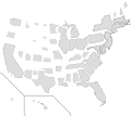
| current | 11:56, 16 September 2017 |  | 407 × 345 (42 KB) | Madshurtie | Updated with new boundaries from File:Blank USA, w territories.svg and File:Blank US Map (states only).svg. Removed outlines because they're ugly and got scaled proportional to population density, which isn't the most useful value. |
| 13:15, 14 September 2017 |  | 395 × 349 (68 KB) | Madshurtie | No idea why this isn't rendering properly on wikipedia. | |
| 13:11, 14 September 2017 |  | 395 × 349 (68 KB) | Madshurtie | Found the scales on the original document File:Map of USA with state names.svg to get slightly more accurate scaling factors. I have adjusted Hawaii as well. | |
| 12:50, 14 September 2017 |  | 395 × 349 (68 KB) | Madshurtie | Didn't upload properly | |
| 12:41, 14 September 2017 |  | 395 × 349 (68 KB) | Madshurtie | Alaska by population shouldn't be smaller than Wyoming and North Dakota. Alaska was too small because the source image File:Blank US Map.svg had a scaled-down Alaska. I have measured the pixel area of the source Alaska and calculated its ratio to... | |
| 20:18, 5 January 2016 |  | 395 × 349 (68 KB) | Mliu92 | Fixed mixup between WY/CO – thanks! | |
| 16:04, 22 September 2015 |  | 395 × 349 (68 KB) | Mliu92 | User created page with UploadWizard |
File usage
The following page uses this file:
Global file usage
The following other wikis use this file:
- Usage on es.wikipedia.org
- Usage on nl.wikipedia.org


