Size of this preview: 529 × 600 pixels. Other resolutions: 212 × 240 pixels | 423 × 480 pixels | 677 × 768 pixels | 903 × 1,024 pixels | 1,767 × 2,004 pixels.
Original file (1,767 × 2,004 pixels, file size: 3.7 MB, MIME type: image/png)
| This is a file from the Wikimedia Commons. Information from its description page there is shown below. Commons is a freely licensed media file repository. You can help. |
Summary
| Description |
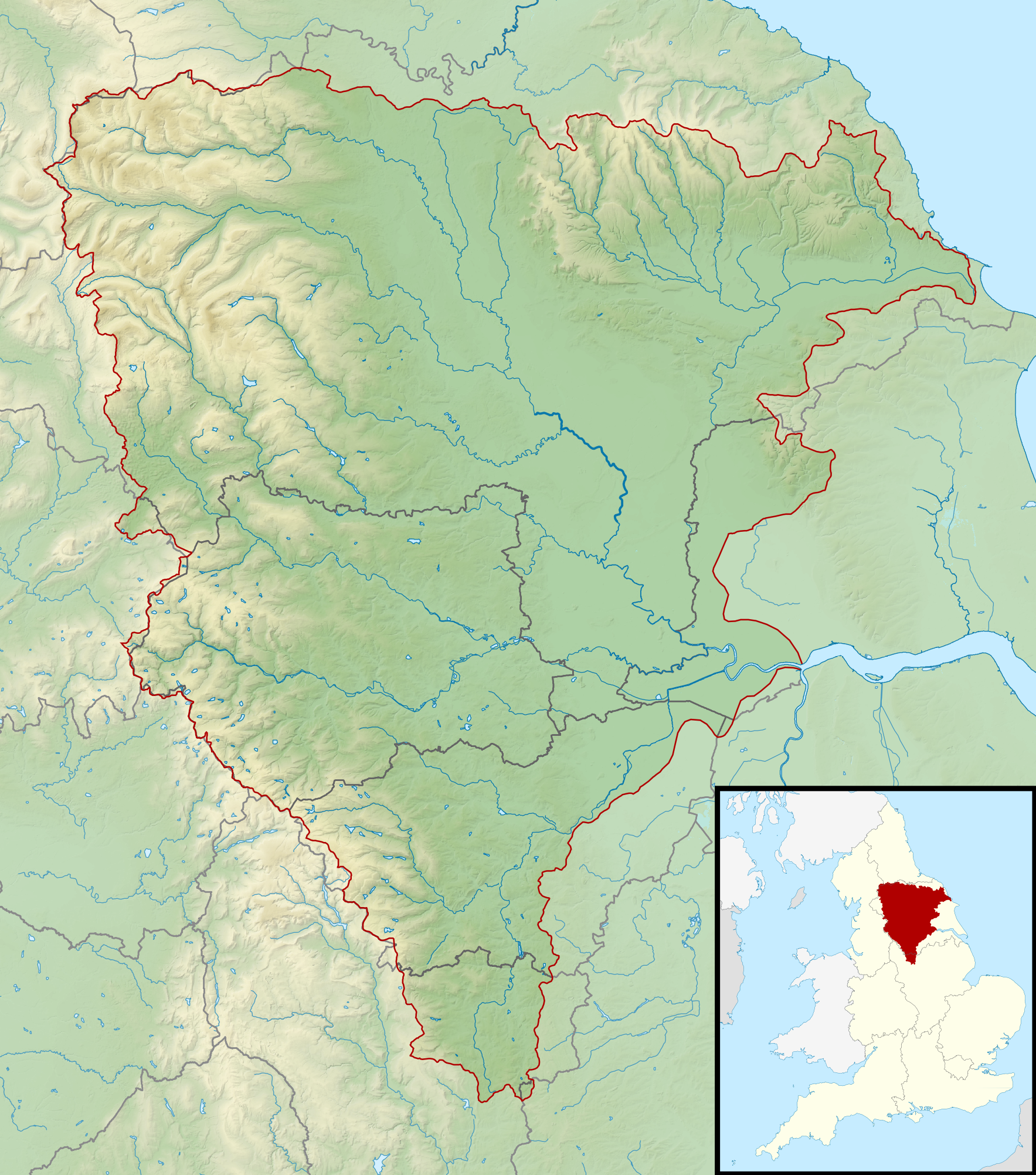
English: Map of the River Ouse and its catchment in England.
Map is on British National Grid with limits at grid refs NY7020 (top left), OV2020 (top right), SJ7050 (bottom left), TF2050 (bottom right). |
| Date | |
| Source |
|
| Author | Nilfanion, created using Ordnance Survey data |
| Permission (Reusing this file) |
This file is licensed under the Creative Commons Attribution-Share Alike 3.0 Unported license. Attribution: Contains Ordnance Survey data © Crown copyright and database right
|
File history
Click on a date/time to view the file as it appeared at that time.
| Date/Time | Thumbnail | Dimensions | User | Comment | |
|---|---|---|---|---|---|
| current | 23:41, 5 March 2014 | | 1,767 × 2,004 (3.7 MB) | Nilfanion | == {{int:filedesc}} == {{Information |Description= {{en|Map of the River Ouse and its catchment in England. Map is on British National Grid with limits at grid refs NY7020 (top left), OV2020 (top right), SJ7050 (bottom left), TF2050 (bottom right).}}... |
File usage
The following page uses this file:
Global file usage
The following other wikis use this file:
- Usage on br.wikipedia.org
- Usage on fy.wikipedia.org
- Usage on nl.wikipedia.org
- Usage on sh.wikipedia.org
- Usage on sr.wikipedia.org