Size of this preview: 800 × 376 pixels. Other resolutions: 320 × 150 pixels | 640 × 301 pixels | 1,024 × 481 pixels | 1,280 × 602 pixels | 2,264 × 1,064 pixels.
Original file (2,264 × 1,064 pixels, file size: 85 KB, MIME type: image/png)
| This is a file from the Wikimedia Commons. Information from its description page there is shown below. Commons is a freely licensed media file repository. You can help. |
Summary
| Description |
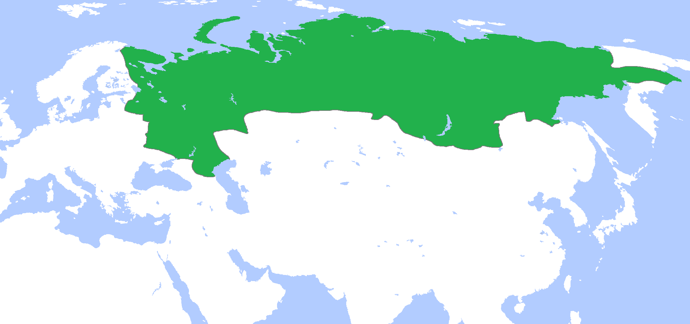
English: Locator map of Russia, c. 1700.
(Partially based on Atlas of World History (2007) - The World 1600-1700, map) |
| Date | |
| Source | Own work |
| Author | Gabagool |
| Other versions | Derivative works of this file: Russian Tsardom 1500 to 1700.png |
Licensing
I, the copyright holder of this work, hereby publish it under the following license:
This file is licensed under the Creative Commons Attribution 3.0 Unported license.
- You are free:
- to share – to copy, distribute and transmit the work
- to remix – to adapt the work
- Under the following conditions:
- attribution – You must give appropriate credit, provide a link to the license, and indicate if changes were made. You may do so in any reasonable manner, but not in any way that suggests the licensor endorses you or your use.
File history
Click on a date/time to view the file as it appeared at that time.
| Date/Time | Thumbnail | Dimensions | User | Comment | |
|---|---|---|---|---|---|
| current | 15:48, 24 April 2009 | | 2,264 × 1,064 (85 KB) | Gabagool | {{Information |Description={{en|1=Locator map of Russia, c. 1700. (Partially based on ''Atlas of World History'' (2007) - The World 1600-1700, map)}} |Source=Own work by uploader |Author=Gabagool / Jarle Grøhn |Date=2009-04-24 |Permiss |
File usage
The following 3 pages use this file:
Global file usage
The following other wikis use this file:
- Usage on af.wikipedia.org
- Usage on ar.wikipedia.org
- Usage on arz.wikipedia.org
- Usage on ast.wikipedia.org
- Usage on ba.wikipedia.org
- Usage on bn.wikipedia.org
- Usage on ca.wikipedia.org
- Usage on de.wikipedia.org
- Usage on eo.wikipedia.org
- Usage on fr.wikipedia.org
- Usage on gl.wikipedia.org
- Usage on hr.wikipedia.org
- Usage on hu.wikipedia.org
- Usage on hy.wikipedia.org
- Usage on ka.wikipedia.org
- Usage on mn.wikipedia.org
- Usage on nn.wikipedia.org
- Usage on pnb.wikipedia.org
- Usage on ru.wikipedia.org
- Usage on ru.wikinews.org
- Usage on ru.wiktionary.org
- Usage on sh.wikipedia.org
- Usage on sr.wikipedia.org
- Usage on tt.wikipedia.org
- Usage on uk.wikipedia.org
- Usage on ur.wikipedia.org
- Usage on vi.wikipedia.org
- Usage on www.wikidata.org
- Usage on xmf.wikipedia.org
- Usage on zh.wikipedia.org