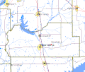
Senatobiacountymap.gif (422 × 359 pixels, file size: 13 KB, MIME type: image/gif)
File history
Click on a date/time to view the file as it appeared at that time.
| Date/Time | Thumbnail | Dimensions | User | Comment | |
|---|---|---|---|---|---|
| current | 19:11, 30 January 2007 |  | 422 × 359 (13 KB) | Badagnani | Map showing location of Senatobia, Mississippi in Tate County, Mississippi. US Government Census map from http://tiger.census.gov/cgi-bin/mapsurfer?infact=2&outfact=2&act=move&on=counties&tlevel=-&tvar=-&tmeth=i&mlat=34.632306&mlon=-89.885501&msy |
File usage
The following 2 pages use this file:

