Size of this preview: 800 × 490 pixels. Other resolutions: 320 × 196 pixels | 640 × 392 pixels | 1,024 × 627 pixels | 1,518 × 929 pixels.
Original file (1,518 × 929 pixels, file size: 665 KB, MIME type: image/png)
| This is a file from the Wikimedia Commons. Information from its description page there is shown below. Commons is a freely licensed media file repository. You can help. |
| Description |
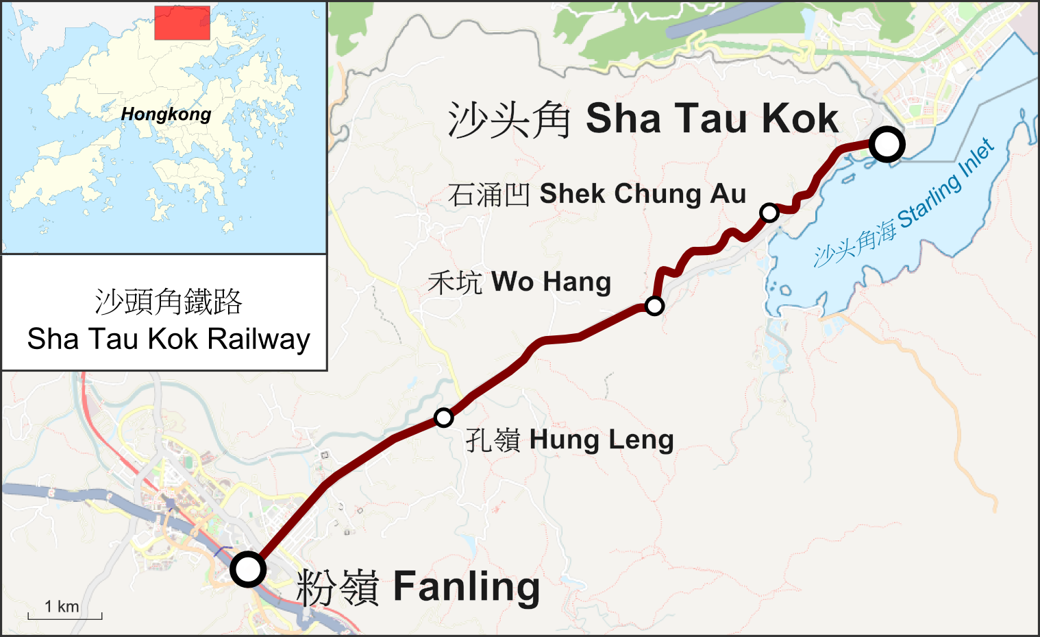
Deutsch: Karte der Sha Tau Kok Railway in Hongkong English: Map of the Sha Tau Kok Railway in Hongkong |
| Date | |
| Source |
Own work Map was created using:
|
| Author | |
| Permission (Reusing this file) |
Map data (c) OpenStreetMap (and) contributors, CC-BY-SA |

|
This rail transport map image could be re-created using vector graphics as an SVG file. This has several advantages; see Commons:Media for cleanup for more information. If an SVG form of this image is available, please upload it and afterwards replace this template with
{{vector version available|new image name}}.
It is recommended to name the SVG file “Sha Tau Kok Railway.svg”—then the template Vector version available (or Vva) does not need the new image name parameter. |
This file is licensed under the Creative Commons Attribution-Share Alike 2.0 Generic license.
- You are free:
- to share – to copy, distribute and transmit the work
- to remix – to adapt the work
- Under the following conditions:
- attribution – You must give appropriate credit, provide a link to the license, and indicate if changes were made. You may do so in any reasonable manner, but not in any way that suggests the licensor endorses you or your use.
- share alike – If you remix, transform, or build upon the material, you must distribute your contributions under the same or compatible license as the original.
File history
Click on a date/time to view the file as it appeared at that time.
| Date/Time | Thumbnail | Dimensions | User | Comment | |
|---|---|---|---|---|---|
| current | 03:14, 25 July 2015 | | 1,518 × 929 (665 KB) | Pechristener | Hung Ling Station located more to the west according co-ordinates of the pic in commons. |
| 08:52, 13 January 2015 |  | 1,518 × 929 (665 KB) | Pechristener | Layout nachgebessert | |
| 08:42, 13 January 2015 |  | 1,518 × 929 (659 KB) | Pechristener | {{Information |Description={{de|1=Karte der Sha Tau Kok Railway in Hongkong}}{{en|1=Map of the Sha Tau Kok Railway}} |Source ={{own}} Map was created using: *[http://www.openstreetmap.or... |
File usage
The following pages on the English Wikipedia use this file (pages on other projects are not listed):
Global file usage
The following other wikis use this file:
- Usage on de.wikipedia.org
- Usage on zh-yue.wikipedia.org