
Size of this PNG preview of this SVG file: 635 × 599 pixels. Other resolutions: 254 × 240 pixels | 509 × 480 pixels | 814 × 768 pixels | 1,085 × 1,024 pixels | 2,171 × 2,048 pixels | 1,772 × 1,672 pixels.
Original file (SVG file, nominally 1,772 × 1,672 pixels, file size: 376 KB)
| This is a file from the Wikimedia Commons. Information from its description page there is shown below. Commons is a freely licensed media file repository. You can help. |
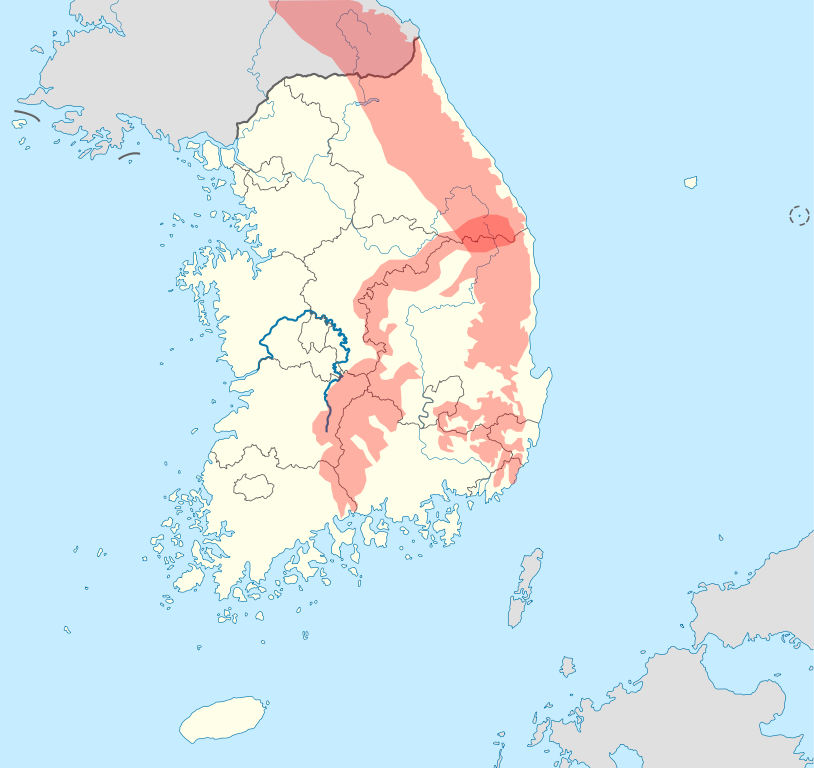
| Description | A map derived from File:South_Korea_location_map.svg. The two major mountains, Taebaek (태백산맥) and Sobaek (소백산맥) Mountains and the Geum River (금강), one of the three major rivers in South Korea, are marked specially so that they can be easily recognized on the map. This map is designed to be an alternative map to the default map (File:South_Korea_location_map.svg) for the w:Template:Location map South Korea. |
| Date | (UTC) |
| Source | |
| Author |
|
Related maps


Copyright information
| This is a retouched picture, which means that it has been digitally altered from its original version. The original can be viewed here: South Korea location map.svg:
|
I, the copyright holder of this work, hereby publish it under the following licenses:
This file is licensed under the Creative Commons Attribution-Share Alike 3.0 Unported license.
- You are free:
- to share – to copy, distribute and transmit the work
- to remix – to adapt the work
- Under the following conditions:
- attribution – You must give appropriate credit, provide a link to the license, and indicate if changes were made. You may do so in any reasonable manner, but not in any way that suggests the licensor endorses you or your use.
- share alike – If you remix, transform, or build upon the material, you must distribute your contributions under the same or compatible license as the original.

|
Permission is granted to copy, distribute and/or modify this document under the terms of the GNU Free Documentation License, Version 1.2 or any later version published by the Free Software Foundation; with no Invariant Sections, no Front-Cover Texts, and no Back-Cover Texts. A copy of the license is included in the section entitled GNU Free Documentation License. |
You may select the license of your choice.
Original upload log
This image is a derivative work of the following images:
- File:South_Korea_location_map.svg licensed with Cc-by-sa-3.0, GFDL
- 2010-10-24T17:48:06Z NordNordWest 1772x1672 (386497 Bytes) upd
- 2010-10-02T20:05:03Z NordNordWest 1559x1672 (357245 Bytes) upd
- 2008-08-26T18:57:44Z NordNordWest 1559x1673 (513639 Bytes) {{Information |Description= {{de|Positionskarte von [[:de:Südkorea|Südkorea]]}} Quadratische Plattkarte, N-S-Streckung 120 %. Geographische Begrenzung der Karte: * N: 38.9° N * S: 33.0° N * W: 124.5° O * O: 131.1° O {{e
Uploaded with derivativeFX
File history
Click on a date/time to view the file as it appeared at that time.
| Date/Time | Thumbnail | Dimensions | User | Comment | |
|---|---|---|---|---|---|
| current | 01:26, 27 October 2010 | | 1,772 × 1,672 (376 KB) | 배우는사람 | {{Information |Description=A map derived from File:South_Korea_location_map.svg. The two major mountains, Taebaek (태백산맥) and Sobaek (소백산맥) Mountains and the Geum River(금강), one of the three major rivers in South Korea, are marked |
File usage
The following page uses this file:
Global file usage
The following other wikis use this file:
- Usage on cs.wikipedia.org
- Usage on es.wikipedia.org
- Usage on fr.wikipedia.org
- Usage on ja.wikipedia.org
- Usage on ko.wikipedia.org
- Usage on vi.wikipedia.org
- Usage on zh.wikipedia.org