No higher resolution available.
St_John's_Almshouses,_Ripon_-_geograph.org.uk_-_1597105.jpg (640 × 427 pixels, file size: 65 KB, MIME type: image/jpeg)
| This is a file from the Wikimedia Commons. Information from its description page there is shown below. Commons is a freely licensed media file repository. You can help. |
Summary
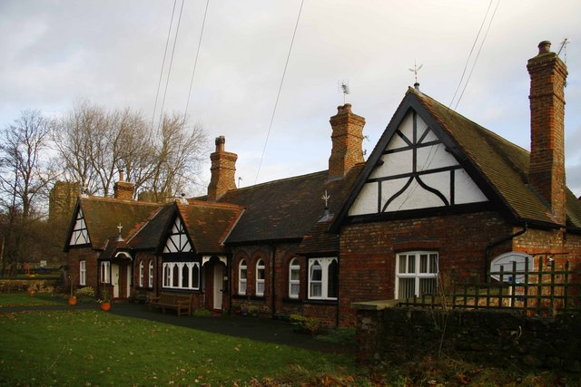
| Description |
English: St John's Almshouses, Ripon Six Almshouses, dating from 1878 by the architect Robert Hargreave Brodick, behind St John's Chapel on Bondgate. |
| Date | |
| Source | From geograph.org.uk |
| Author | David Rogers |
| Attribution (required by the license) | David Rogers / St John's Almshouses, Ripon / |
| Camera location | | View this and other nearby images on: OpenStreetMap |
|---|
_heading:0.00&language=en)
| Object location | | View this and other nearby images on: OpenStreetMap |
|---|
_heading:0.00&language=en)
Licensing

|
This image was taken from the Geograph project collection. See this photograph's page on the Geograph website for the photographer's contact details. The copyright on this image is owned by David Rogers and is licensed for reuse under the Creative Commons Attribution-ShareAlike 2.0 license.
|
This file is licensed under the Creative Commons Attribution-Share Alike 2.0 Generic license.
Attribution: David Rogers
- You are free:
- to share – to copy, distribute and transmit the work
- to remix – to adapt the work
- Under the following conditions:
- attribution – You must give appropriate credit, provide a link to the license, and indicate if changes were made. You may do so in any reasonable manner, but not in any way that suggests the licensor endorses you or your use.
- share alike – If you remix, transform, or build upon the material, you must distribute your contributions under the same or compatible license as the original.
File history
Click on a date/time to view the file as it appeared at that time.
| Date/Time | Thumbnail | Dimensions | User | Comment | |
|---|---|---|---|---|---|
| current | 04:10, 4 March 2011 | | 640 × 427 (65 KB) | GeographBot | == {{int:filedesc}} == {{Information |description={{en|1=St John's Almshouses, Ripon Six Almshouses, built sometime between 1856 and 1892 behind St John's Chapel on Bondgate.}} |date=2009-11-27 |source=From [http://www.geograph.org.uk/photo/1597105 geogra |
File usage
The following page uses this file:
Global file usage
The following other wikis use this file:
- Usage on ig.wikipedia.org
- Usage on www.wikidata.org