Size of this preview: 527 × 600 pixels. Other resolutions: 211 × 240 pixels | 422 × 480 pixels | 675 × 768 pixels | 899 × 1,024 pixels | 1,445 × 1,645 pixels.
Original file (1,445 × 1,645 pixels, file size: 170 KB, MIME type: image/png)
File history
Click on a date/time to view the file as it appeared at that time.
| Date/Time | Thumbnail | Dimensions | User | Comment | |
|---|---|---|---|---|---|
| current | 00:04, 19 December 2023 |  | 1,445 × 1,645 (170 KB) | AceYYC | highway complete |
| 06:09, 19 October 2023 |  | 1,445 × 1,645 (168 KB) | AceYYC | 2023 upd 2 | |
| 06:07, 19 October 2023 |  | 1,445 × 1,645 (174 KB) | AceYYC | 2023 upd | |
| 03:05, 2 October 2021 |  | 1,445 × 1,645 (166 KB) | AceYYC | update map | |
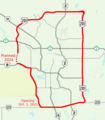
| 22:23, 24 August 2020 |  | 1,445 × 1,645 (179 KB) | AceYYC | == {{int:filedesc}} == {{Information |description={{en|1=Stoney Trail - created with OpenStreetMap}} |date=2020-06-27 |source={{own}} |author=AceYYC, OpenStreetMap contributors |permission= |other versions= }} == {{int:license-header}} == {{self|cc-by-sa-3.0}} Category:Maps of Calgary Category:Alberta Highway 201 Category:Maps of beltways Category:Road maps of Alberta |
File usage
The following page uses this file:
Global file usage
The following other wikis use this file:
- Usage on de.wikipedia.org
- Usage on de.wikivoyage.org