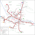
Size of this PNG preview of this SVG file: 602 × 600 pixels. Other resolutions: 241 × 240 pixels | 482 × 480 pixels | 771 × 768 pixels | 1,028 × 1,024 pixels | 2,055 × 2,048 pixels | 2,024 × 2,017 pixels.
Original file (SVG file, nominally 2,024 × 2,017 pixels, file size: 934 KB)
File history
Click on a date/time to view the file as it appeared at that time.
| Date/Time | Thumbnail | Dimensions | User | Comment | |
|---|---|---|---|---|---|
| current | 07:40, 17 February 2021 |  | 2,024 × 2,017 (934 KB) | Pechristener | Korrektur Datum in Legende |
| 07:37, 17 February 2021 |  | 2,024 × 2,017 (934 KB) | Pechristener | Aktualisierung auf Stand Dezember 2020 (Inbetriebnahme Verlängerung zur Messe) | |
| 22:03, 22 February 2019 |  | 2,024 × 2,017 (929 KB) | Pechristener | Aktualisiert auf Stand März 2019: * Rotteckring in Betrieb * Umbenennung Siegesdenkmal in Europaplatz * Neue Linienführung der 2 und der 5 * geplante Verlegung der Stadtbahn in die Waldkircher Straße | |
| 15:33, 3 December 2015 |  | 2,024 × 2,017 (920 KB) | Pechristener | Aktualisiert auf Stand Dez 2015: * erste Bauabschnitt der Stadtbahn Messe eröffnet * Abschnitt Robert-Koch-Straße – Technische Fakultät als "In Betrieb" markiert * Haltestelle "Berliner Allee" * Die Linie 2 wurde generell auf Hornusstraße–Gü... | |
| 09:47, 12 April 2014 |  | 2,024 × 2,017 (917 KB) | Pechristener | Anschluss zum Betriebshof Süd als Bestandsstrecke dargestellt / ehemaligen Anschlüsse zum Betriebshof Nord als stillgelegte Strecke dargestellt. | |
| 06:55, 25 March 2014 |  | 2,024 × 2,017 (914 KB) | Pechristener | Einheitliche Farbe für die Linie 5 / diskretes Symbol für die Bhfs / amtliche Schreibweise der Bahnstationen / Ensisheimer Straße / Legende | |
| 13:58, 16 March 2014 |  | 2,024 × 2,017 (922 KB) | Pechristener | Berggasse statt Bergstrasse | |
| 09:02, 16 March 2014 |  | 2,024 × 2,017 (912 KB) | Pechristener | weisser Hintergrund hinzu | |
| 08:55, 16 March 2014 |  | 2,024 × 2,017 (912 KB) | Pechristener | Nachgebessert: Strecke zur Messe macht in den aktuellen Plaunungen keinen Knick mehr / ehemaligen Eisenbahnstrecke durch die Wiehre: Strichelung vereinheitlicht / Bertoldsbrunnen / Robert-Koch-Straße / Eichstetter Straße / Schwabentorbrücke / Reuteb... | |
| 20:07, 15 March 2014 |  | 2,024 × 2,017 (925 KB) | Pechristener | == {{int:filedesc}} == {{Information |Description={{de|1=Netzplan der Freiburger Straßenbahn (Stand März 2014)}}{{en|1=Map of the Freiburg streetcar network (as of March 2014)}}{{fr|1=Plan réseau des tramways de Friburg (mars 2014)}} |date=2014-03-1... |
File usage
The following page uses this file:
Global file usage
The following other wikis use this file:
- Usage on als.wikipedia.org
- Usage on de.wikipedia.org
- Usage on fa.wikipedia.org
- Usage on fi.wikipedia.org
- Usage on fr.wikipedia.org
- Usage on it.wikipedia.org
- Usage on nl.wikipedia.org
- Usage on www.wikidata.org
