
Size of this preview: 800 × 415 pixels. Other resolutions: 320 × 166 pixels | 640 × 332 pixels | 1,432 × 742 pixels.
Original file (1,432 × 742 pixels, file size: 57 KB, MIME type: image/png)
| This is a file from the Wikimedia Commons. Information from its description page there is shown below. Commons is a freely licensed media file repository. You can help. |
Summary
| Description |
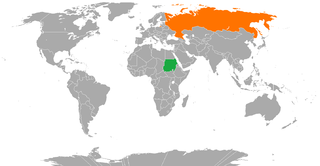
English: Sudan-Russia Locator map |
| Date | 9 July 2011 (original upload date) |
| Source | Phoenix_B_1of3 (talk) (Uploads) |
| Author | Phoenix_B_1of3 (talk) (Uploads) |
Licensing
Phoenix B 1of3 at English Wikipedia, the copyright holder of this work, hereby publishes it under the following license:
| This file is made available under the Creative Commons CC0 1.0 Universal Public Domain Dedication. | |
| The person who associated a work with this deed has dedicated the work to the public domain by waiving all of their rights to the work worldwide under copyright law, including all related and neighboring rights, to the extent allowed by law. You can copy, modify, distribute and perform the work, even for commercial purposes, all without asking permission.
|
Original upload log
The original description page was here. All following user names refer to en.wikipedia.
- 2011-07-09 13:37 Phoenix B 1of3 1432×742 (58186 bytes)
File history
Click on a date/time to view the file as it appeared at that time.
| Date/Time | Thumbnail | Dimensions | User | Comment | |
|---|---|---|---|---|---|
| current | 14:01, 16 June 2014 | | 1,432 × 742 (57 KB) | Denniss | Reverted to version as of 10:53, 16 June 2014 |
| 13:40, 16 June 2014 |  | 1,432 × 742 (45 KB) | WhyHellWhy | Reverted to version as of 19:11, 30 May 2014 | |
| 10:53, 16 June 2014 |  | 1,432 × 742 (57 KB) | Denniss | Reverted to version as of 16:53, 24 February 2012 | |
| 19:11, 30 May 2014 |  | 1,432 × 742 (45 KB) | WhyHellWhy | Crimea;Kuril islands | |
| 16:53, 24 February 2012 |  | 1,432 × 742 (57 KB) | MGA73bot2 | == {{int:filedesc}} == {{Information |description={{en|1=Sudan-Russia Locator map}} |date={{Date|2011|7|9}} (original upload date) |source=Phoenix_B_1of3 (talk) ([{{fullurl:Special:Listfiles|... |
File usage
The following page uses this file:
Global file usage
The following other wikis use this file:
- Usage on ar.wikipedia.org
- Usage on he.wikipedia.org
- Usage on pt.wikipedia.org
- Usage on ru.wikipedia.org
- Usage on www.wikidata.org