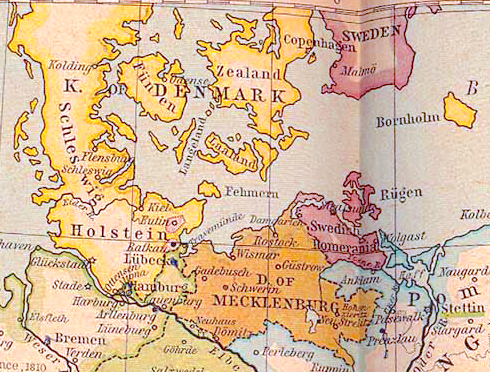
Swedish_Pomerania_1812.png (490 × 372 pixels, file size: 490 KB, MIME type: image/png)
File history
Click on a date/time to view the file as it appeared at that time.
| Date/Time | Thumbnail | Dimensions | User | Comment | |
|---|---|---|---|---|---|
| current | 10:30, 8 July 2020 |  | 490 × 372 (490 KB) | 0m9Ep | Brightness, color |
| 21:44, 6 May 2007 |  | 490 × 372 (405 KB) | OwenBlacker | {{Information |Description=en:Swedish Pomerania as at 1812 |Source=[http://www.lib.utexas.edu/maps/historical/shepherd/central_europe_1812.jpg Central Europe in 1812], excerpted from ''The Historical Atlas'' by William R. Shepherd, 1926. File ta |
File usage
The following 4 pages use this file:
Global file usage
The following other wikis use this file:
- Usage on ar.wikipedia.org
- Usage on be-tarask.wikipedia.org
- Usage on be.wikipedia.org
- Usage on ca.wikipedia.org
- Usage on cs.wikipedia.org
- Usage on de.wikipedia.org
- Usage on es.wikipedia.org
- Usage on et.wikipedia.org
- Usage on fr.wikipedia.org
- Usage on he.wikipedia.org
- Usage on hu.wikipedia.org
- Usage on id.wikipedia.org
- Usage on is.wikipedia.org
- Usage on it.wikipedia.org
- Usage on ja.wikipedia.org
- Usage on nl.wikipedia.org
- Usage on pt.wikipedia.org
- Usage on ru.wikipedia.org
- Usage on sk.wikipedia.org
- Usage on sv.wikipedia.org
- Usage on www.wikidata.org


