Size of this PNG preview of this SVG file: 620 × 600 pixels. Other resolutions: 248 × 240 pixels | 496 × 480 pixels | 794 × 768 pixels | 1,059 × 1,024 pixels | 2,117 × 2,048 pixels | 1,287 × 1,245 pixels.
Original file (SVG file, nominally 1,287 × 1,245 pixels, file size: 391 KB)
File history
Click on a date/time to view the file as it appeared at that time.
| Date/Time | Thumbnail | Dimensions | User | Comment | |
|---|---|---|---|---|---|
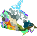
| current | 02:20, 23 November 2020 |  | 1,287 × 1,245 (391 KB) | Ponderosapine210 | Added Manitoulin Island. |
| 04:02, 22 November 2020 |  | 1,287 × 1,245 (389 KB) | Ponderosapine210 | Uploaded a work by Cephas (original author); Ponderosapine210 (editor) from *North America second level political division 2.svg *''Terrestrial ecoregions of North America : a conservation assessment''. Taylor H Ricketts; et al. Washington, D.C. : Island Press, ©1999. xxiv, 485 p. : ill. (some col.), maps (some col.) ; 28 cm. ({{ISBN|9781559637220}}) with UploadWizard |
File usage
The following page uses this file:
