Size of this preview: 465 × 600 pixels. Other resolutions: 186 × 240 pixels | 372 × 480 pixels | 595 × 768 pixels | 793 × 1,024 pixels | 1,587 × 2,048 pixels | 6,200 × 8,000 pixels.
Original file (6,200 × 8,000 pixels, file size: 8.49 MB, MIME type: image/jpeg)
File history
Click on a date/time to view the file as it appeared at that time.
| Date/Time | Thumbnail | Dimensions | User | Comment | |
|---|---|---|---|---|---|
| current | 17:39, 11 January 2019 |  | 6,200 × 8,000 (8.49 MB) | FleurDeOdile | 250m |
| 22:49, 14 October 2012 |  | 1,463 × 1,687 (1.97 MB) | Supportstorm | Better File | |
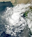
| 00:35, 6 February 2007 |  | 840 × 840 (198 KB) | Good kitty | == Summary == {{Information |Description=MODIS satellite image of Tropical Cyclone 03A near peak intensity from October 9 at 0555 UTC. Maximum sustained winds were about 35 mph at the time. |Source=http://modis-atmos.gsfc.nasa.gov/IMAGES/MOD02/GRANULE/200 |
File usage
The following 2 pages use this file:
Global file usage
The following other wikis use this file:
- Usage on zh.wikipedia.org

