Size of this preview: 775 × 600 pixels. Other resolutions: 310 × 240 pixels | 620 × 480 pixels | 992 × 768 pixels | 1,280 × 991 pixels | 1,500 × 1,161 pixels.
Original file (1,500 × 1,161 pixels, file size: 866 KB, MIME type: image/png)
File history
Click on a date/time to view the file as it appeared at that time.
| Date/Time | Thumbnail | Dimensions | User | Comment | |
|---|---|---|---|---|---|
| current | 21:27, 12 August 2008 |  | 1,500 × 1,161 (866 KB) | Davumaya | {{Information |Description= |Source= |Date= |Author= |Permission= |other_versions= }} <!--{{ImageUpload|basic}}--> |
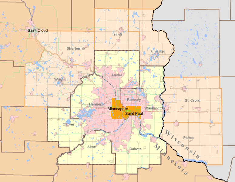
| 21:22, 12 August 2008 |  | 2,000 × 1,545 (238 KB) | Davumaya | {{Information |Description=Minneapolis-Saint Paul (Twin Cities) highlighting both the 7-county Urban Area (traditional) and the revised 13-county Metropolitan Statistical Area from the 2000 Census. |Source=Own work by uploader using publicly and freely a |
File usage
The following 2 pages use this file:
Global file usage
The following other wikis use this file:
- Usage on de.wikipedia.org
- Usage on fi.wikipedia.org
- Usage on ja.wikipedia.org
- Usage on nl.wikipedia.org
- Usage on pl.wikipedia.org
- Usage on ro.wikipedia.org
- Usage on simple.wikipedia.org
- Usage on sv.wikipedia.org
- Usage on vi.wikipedia.org