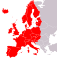
Västeuropa-karta.png (415 × 332 pixels, file size: 77 KB, MIME type: image/png)
File history
Click on a date/time to view the file as it appeared at that time.
| Date/Time | Thumbnail | Dimensions | User | Comment | |
|---|---|---|---|---|---|
| current | 19:36, 31 October 2022 |  | 415 × 332 (77 KB) | Рагин1987 | Extended map |
| 17:45, 6 May 2007 |  | 415 × 422 (10 KB) | Bruno Rosta | {{Information |Description= |Source= |Date= |Author= |Permission= |other_versions= }} | |
| 14:13, 6 May 2007 |  | 415 × 422 (10 KB) | Aaker | {{Information |Description=Karta över västeuropa, kulurellt sätt |Source=Eget verk/ Own work |Date=6 maj 2007 |Author=aaker |Permission= |other_versions= }} |
File usage
The following 2 pages use this file:
Global file usage
The following other wikis use this file:
- Usage on af.wikipedia.org
- Usage on ca.wikipedia.org
- Usage on hr.wikipedia.org
- Usage on lv.wikipedia.org
- Usage on no.wikipedia.org
- Usage on pl.wikipedia.org
- Usage on tr.wikipedia.org
