Size of this preview: 600 × 600 pixels. Other resolutions: 240 × 240 pixels | 480 × 480 pixels | 768 × 768 pixels | 1,024 × 1,024 pixels | 2,048 × 2,048 pixels | 18,600 × 18,600 pixels.
Original file (18,600 × 18,600 pixels, file size: 46.48 MB, MIME type: image/jpeg)
File history
Click on a date/time to view the file as it appeared at that time.
| Date/Time | Thumbnail | Dimensions | User | Comment | |
|---|---|---|---|---|---|
| current | 19:43, 30 April 2022 |  | 18,600 × 18,600 (46.48 MB) | Scewing | Higher resolution |
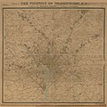
| 19:19, 30 April 2022 |  | 4,650 × 4,650 (4.38 MB) | Scewing | {{Map |title =The vicinity of Washington, D.C. |description =- Partial cadastral map showing buildings and householders' names beyond city limits. - Relief shown by contours. - Also shows radial distances from White House. - "Entered according to Act of Congress, in the year 1894, by G.M. Hopkins ..." - Stephenson. Cartography of northern Virginia, pl. 95-98 - Includes note. - Available also through the Library of Congress Web site as a raster image. - LC copies da... |
File usage
No pages on the English Wikipedia use this file (pages on other projects are not listed).


