
Size of this PNG preview of this SVG file: 558 × 600 pixels. Other resolutions: 223 × 240 pixels | 446 × 480 pixels | 714 × 768 pixels | 953 × 1,024 pixels | 1,905 × 2,048 pixels | 2,000 × 2,150 pixels.
Original file (SVG file, nominally 2,000 × 2,150 pixels, file size: 1.71 MB)
| This is a file from the Wikimedia Commons. Information from its description page there is shown below. Commons is a freely licensed media file repository. You can help. |
Summary
| Description |
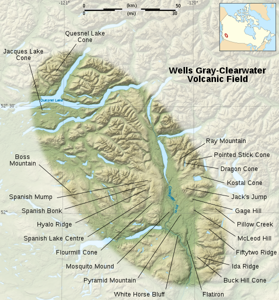
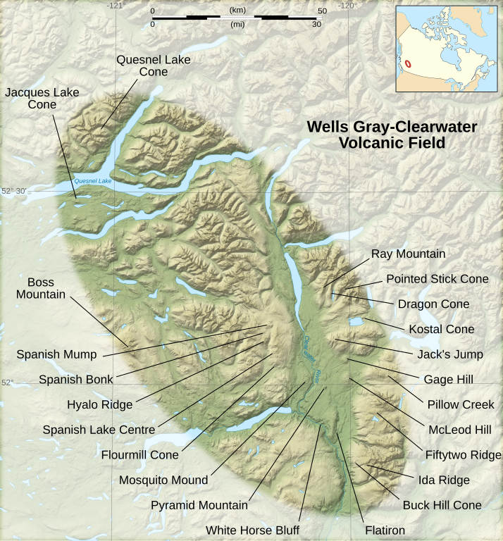
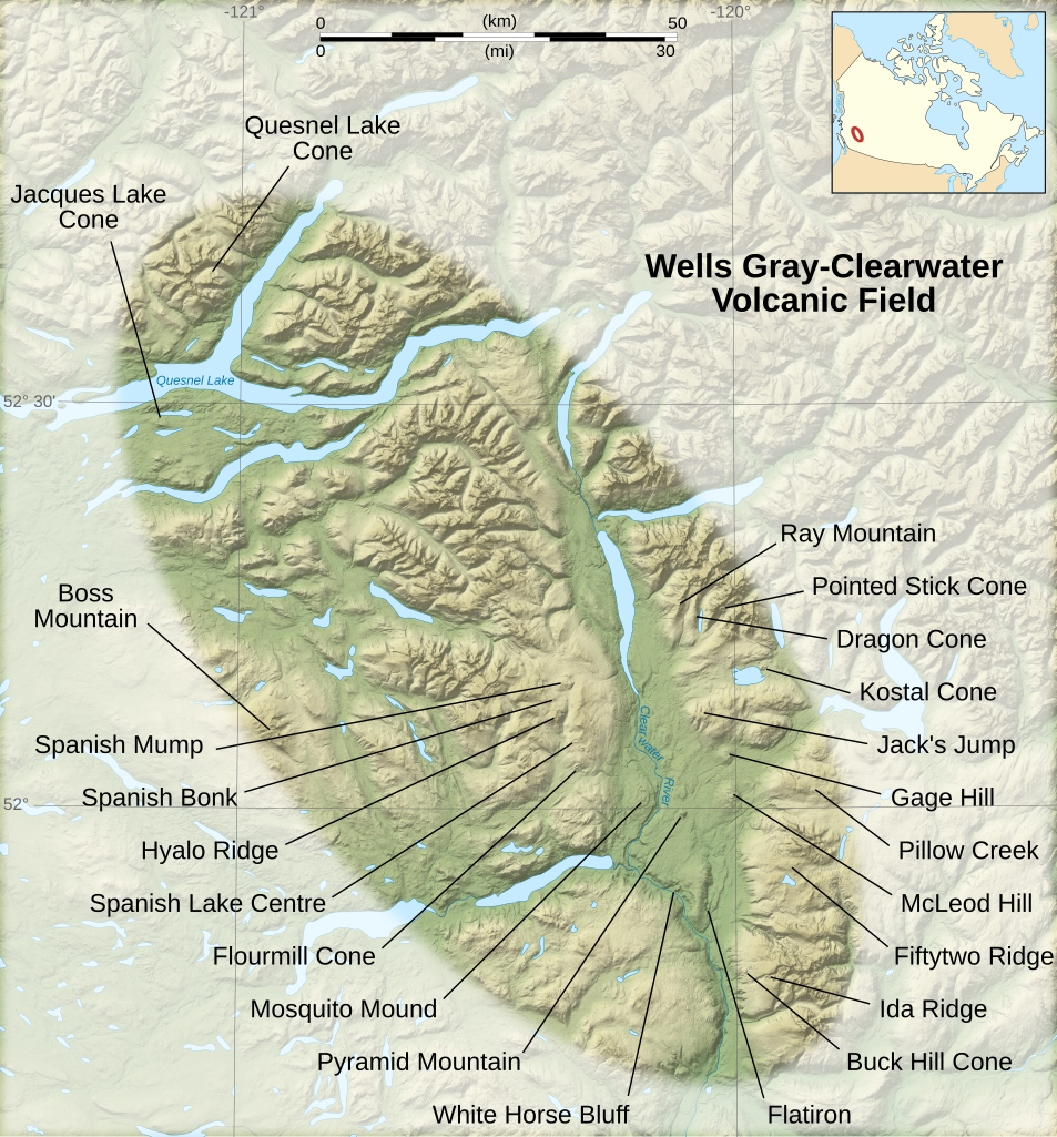
English: Map of the Wells Gray-Clearwater Volcanic Field.
Français : Carte de la chaîne volcanique de Wells Gray-Clearwater, une suite de volcans de Colombie Britannique, Canada. |
||
| Date | |||
| Source |
Own work.
|
||
| Author | Sémhur | ||
| Other versions |
File:Wells Gray-Clearwater Volcanic Field-fr.svg french version | ||
| Attribution (required by the license) | © Sémhur / Wikimedia Commons / | ||
| SVG | W3C-validity not checked.
|
||
| Graphic Lab |

.svg)
| Camera location | | View this and other nearby images on: OpenStreetMap |
|---|
Licensing
I, the copyright holder of this work, hereby publish it under the following licenses:
| Copyleft: This work of art is free; you can redistribute it and/or modify it according to terms of the Free Art License. You will find a specimen of this license on the Copyleft Attitude site as well as on other sites. |
This file is licensed under the Creative Commons Attribution-Share Alike Attribution-Share Alike 4.0 International, 3.0 Unported, 2.5 Generic, 2.0 Generic and 1.0 Generic license.
- You are free:
- to share – to copy, distribute and transmit the work
- to remix – to adapt the work
- Under the following conditions:
- attribution – You must give appropriate credit, provide a link to the license, and indicate if changes were made. You may do so in any reasonable manner, but not in any way that suggests the licensor endorses you or your use.
- share alike – If you remix, transform, or build upon the material, you must distribute your contributions under the same or compatible license as the original.
You may select the license of your choice.
File history
Click on a date/time to view the file as it appeared at that time.
| Date/Time | Thumbnail | Dimensions | User | Comment | |
|---|---|---|---|---|---|
| current | 09:49, 13 June 2008 | | 2,000 × 2,150 (1.71 MB) | Sémhur | Typography : cone => Cone |
| 19:19, 12 June 2008 |  | 2,000 × 2,150 (1.71 MB) | Sémhur | == Description == {{Information| Description= {{en}}Map of the Wells Gray-Clearwater Volcanic Field, a range of volcanoes in British Columbia, Canada. {{fr}}Carte de la chaîne volcanique de Wells Gray-Clearwater, une suite de volcans de Colombie Britann |
File usage
The following pages on the English Wikipedia use this file (pages on other projects are not listed):