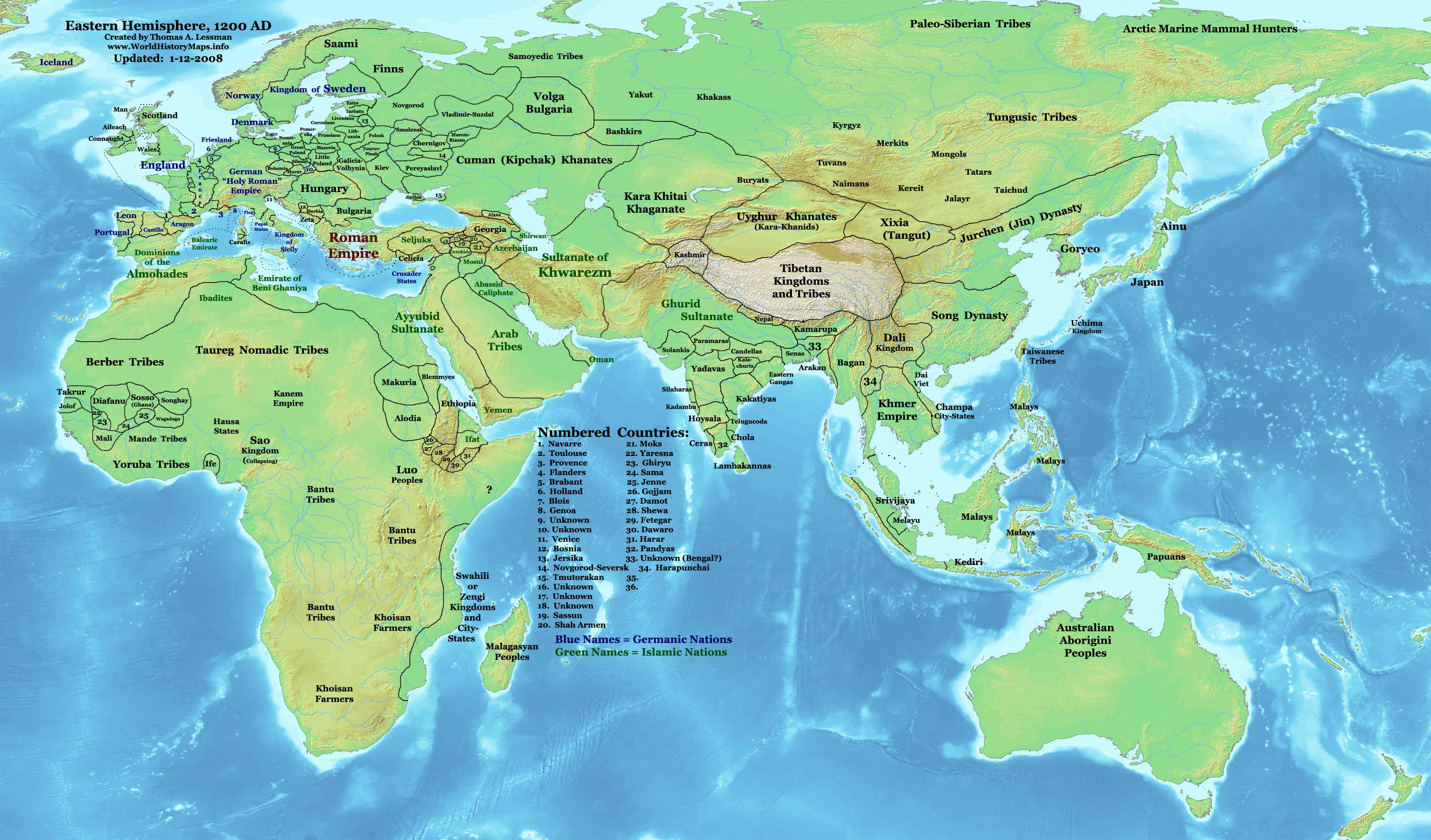
This picture shows wrong place for the Tatars. Instead there were the Barga tumen. Tatars were close to the borde of the Jin and the Onggirats. --Enerelt (talk) 03:13, 25 November 2008 (UTC)
http://www.worldhistorymaps.info/images/East-Hem_1200ad.jpg you can clearly see the hungarians that modified this map about Cumania and Hungary are clearly dreaming on! —Preceding unsigned comment added by 92.83.156.54 (talk) 20:27, 14 March 2009 (UTC)
Why does Venice hold parts of Greece? This map is from before the 4th Crusade.--English Bobby (talk) 18:02, 19 May 2010 (UTC)
Remarks
edit
The map is fine. But I think it can be more accurate.
- Yakuts are in Western Siberia. Who are these people ? If the they are the precedessor of modern Sakha people they should be in the east, around Lena river.
- What is the difference between Maygars and the Bashkirs ? Weren’t they the very same people back in the 13th century ?
- Uyghurs are almost in Mongolia. But they had already been forced to their present country in modern West China back in the 9th century.
- There is a small state named Diyarbakır. Actually Diyarbakır is a city. There is no mention of such a city state in history books. The city was a part of Seljuks and Ayyubids. Nedim Ardoğa (talk) 06:05, 14 July 2010 (UTC)
Hindu States
edit
Why hasn't each indivudal 'Hindu State' been drawn onto the map? I understand it might be difficult if there are too many and they are too small, but since Venice has been drawn, and Venice also is small, that doesn't seem to be an issue.theBOBbobato (talk) 13:45, 2 October 2010 (UTC) In the old days the island republic now known as Sri Lanka was known as Kandy. —Preceding unsigned comment added by 92.18.72.122 (talk) 12:33, 1 May 2011 (UTC)
Sardinia
edit
why the island of sardinia has got the same color of sicily and southern italy???? —Preceding unsigned comment added by 62.10.233.138 (talk) 19:39, 2 October 2010 (UTC)
Ghurid Sultanate is too large and overlaps the Rajput kingdoms/confederacy
edit
This map is totally inaccurate with regards to the Ghurid Sultanate in Northern India. During this period the large Hindu Rajput Kingdoms of Mewar with their capital at Chitor, Marwar, Ajmer (under the Chauhans rajputs), as well as Jaisalmer and the Pratiharas kingdoms maintained their independence and where by no means part of any 'Sultanate'. This fact remains true, as their independence was retained until the time of the Mughal empire in the Mid 1500's which is a well documented fact in medieval Indian history. Therefore the areas which forms the present day state of Rajasthan, should become a seperate identity, as has been done with the Kingdom of Malwa in this map, if historical accuracy is of any importance to wikipedia. — Preceding unsigned comment added by 14.98.128.179 (talk) 10:48, 26 June 2012 (UTC)
Pagans
edit
uh guys why does the brown territory in southeast asia is called pagans? --201.173.24.94 (talk) 02:48, 10 December 2013 (UTC)