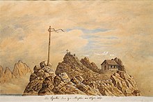
The Grosser Mythen (also Grosse Mythe) is a mountain in the Schwyzer Alps of Central Switzerland. The mountain lies in the canton of Schwyz, to the east of the town of Schwyz, and to the south of the village of Alpthal in the valley of the river Alp.[2]
| Grosser Mythen | |
|---|---|
 Kleiner Mythen (left) and Grosser Mythen (right) | |
| Highest point | |
| Elevation | 1,898 m (6,227 ft) |
| Prominence | 493 m (1,617 ft)[1] |
| Coordinates | 47°01′47″N 8°41′19.7″E / 47.02972°N 8.688806°E |
| Geography | |
| Location | Schwyz, Switzerland |
| Parent range | Schwyzer Alps |
It is accessible from the Holzegg by a hiking trail which is opened during the summer months only. Geologically the Mythen is a penninic Klippe.
The name is pronounced [ˈmiːtən]; it is in origin the plural referring to the Grosser and Kleiner Mythen collectively, each of which had the name Mythe (feminine) in the singular. The name is unrelated to the now-homographic German word for "myth"; Weibel (1973) derives it from Latin meta "cone, pyramid". Until the late 19th century, the name of the mountain was still feminine, die Grosse Mythe; after c. 1870, the masculine gender became increasingly common in written German although dialectically the feminine remains current.[3]

References
edit- ^ Retrieved from the Swisstopo topographic maps. The key col is the Holzegg (1,405 m).
- ^ "33 Toggenburg" (Map). Mythen. [1:100,000]. National Map 1:100'000. Wabern, Switzerland: Swiss Federal Office of Topography swisstopo. 2007. Retrieved 2016-01-19 – via geo.admin.ch.
- ^ Viktor Weibel, 'Namenkunde des Landes Schwyz. Die Orts- und Flurnamen in ihrer historischen Schichtung und dialektologischen Relevanz'. In: Studia Linguistica Alemannica vol. 1, Frauenfeld, 1973. Use of y for [iː] in Swiss toponyms is widespread (as e.g. in Schwyz itself) and arises with a ligature ij as used 15th-century handwriting.
External links
edit- Media related to Gross Mythen at Wikimedia Commons
- Grosser Mythen on Hikr
