Hazaribagh (Bengali: হাজারীবাগ) is a Thana of Dhaka District in the Division of Dhaka, Bangladesh. Hazaribagh is part of Old Town, Dhaka, Bangladesh. 95% of Bangladesh's tanneries, which is where animal skins are processed to make leather, were located in or around Hazaribagh before they moved to Hemayatpur, Savar. In Hazaribagh, traditional establishments, culture, language and food can be found in daily life practices. Owing to its location near Buriganga River, Hazaribagh shares significant history as well. It is one of the most densely populated places on earth, though it is criticised for its low living standards.
Hazaribagh Thana
হাজারীবাগ থানা | |
|---|---|
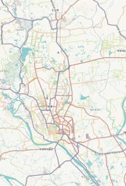
 Expandable map of vicinity of Hazaribagh Thana | |
| Coordinates: 23°44′05″N 90°22′10″E / 23.734722°N 90.369444°E | |
| Country | |
| Division | Dhaka Division |
| District | Dhaka District |
| Area | |
| • Total | 3.6 km2 (1.4 sq mi) |
| Elevation | 23 m (75 ft) |
| Population | |
| • Total | 200,467 |
| • Density | 51,854/km2 (134,300/sq mi) |
| Time zone | UTC+6 (BST) |
| Postal code | 1209 |
| Area code | 02[3] |
Geography
editTotal area of Hazaribagh Thana is 3.58 km2.
Demographics
editAccording to the 2011 Census of Bangladesh, Hazaribagh Thana had 43,740 households and a population of 185,639. Males constituted 54.29% (100,776) of the population while females 45.71% (84,863). Hazaribagh had a literacy rate (age 7 and over) of 67.3%, compared to the national average of 51.8%, and a sex ratio of 119.There were 792 floating people in this jurisdiction. [4][5]
The religious breakdown was Muslim 95.51% (177,312), Hindu 4.39% (8,151), Christian 0.06% (118), Buddhist 0.03% (57), and others 0.01% (1). The ethnic minority people lived there were 61 in total.
Administration
editHazaribagh has 3 Unions/Wards, 15 Mauzas/Mahallas, and 1 village.
Hazaribag Girls' School and College (1971)
edit- Moneshwar Government Primary School (1964) [6]
- Mukulika High School (1981)[7]
- Shahid Sheikh Rasel Government High School (2011)[8]
- Saleha School And College
- Gojmohal Tannery High School (1988)
- Institute of Leather Engineering and Technology, University of Dhaka . This is an Institute of the Dhaka University since 2011, It has contain 3 department of Unit-A of Dhaka University.
See also
editReferences
edit- ^ "Geographic coordinates of Dhaka, Bangladesh". DATEANDTIME.INFO. Retrieved 7 July 2016.
- ^ National Report (PDF). Population and Housing Census 2022. Vol. 1. Dhaka: Bangladesh Bureau of Statistics. November 2023. p. 386. ISBN 978-9844752016.
- ^ "Bangladesh Area Code". China: Chahaoba.com. 18 October 2024.
- ^ a b "Bangladesh Population and Housing Census 2011 Zila Report – Dhaka" (PDF). bbs.gov.bd. Bangladesh Bureau of Statistics.
- ^ "Community Tables: Dhaka district" (PDF). bbs.gov.bd. 2011.
- ^ সাধারণ তথ্য [General Information]. Bangladesh Bureau of Educational Information and Statistics (in Bengali). Retrieved 28 January 2020.
- ^ সাধারণ তথ্য [General Information]. Bangladesh Bureau of Educational Information and Statistics (in Bengali). Retrieved 28 January 2020.
- ^ সাধারণ তথ্য [General Information]. Bangladesh Bureau of Educational Information and Statistics (in Bengali). Retrieved 28 January 2020.


