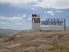
Kyzylart Pass (Russian: Кызыл-Арт; Kyrgyz: Кызыл-Арт ашуусу) is a mountain pass and border crossing in the Trans-Alay Range on the border of Tajikistan and Kyrgyzstan. The highest point is 4,280 m (14,042 ft).[1] The border checkpoint on the Kyrgyz side is Bor-Döbö.[2] The area is typically rugged and dry. It is crossed by the Pamir Highway which leads south from Sary-Tash in the Alay Valley up onto the Pamir plateau toward Karakol Lake and Murghab, Tajikistan. In the late nineteenth century the Russians explored and eventually occupied the Pamir plateau.
| Kyzylart Pass | |
|---|---|
| Kyrgyz: Кызыл-Арт ашуусу | |
 | |
| Elevation | 4,280 m (14,042 ft) |
| Location | Kyrgyzstan–Tajikistan border |
| Range | Trans-Alay Range |
| Coordinates | 39°23′03.60″N 73°19′21″E / 39.3843333°N 73.32250°E |
Gallery
edit-
Ascent to the pass
-
Yaki on the pass
-
Kilometers on the pass
-
Pamir Highway near the Kyzyl Art Pass
References
edit- ^ "Кызыларт ашуусу" [Kyzylart Pass] (PDF). Кыргызстандын Географиясы [Geography of Kyrgyzstan] (in Kyrgyz). Bishkek. 2004. p. 87.
{{cite encyclopedia}}: CS1 maint: location missing publisher (link) - ^ Electronic visa information, accessed 31 January 2022.
- Laurence Mitchell, Kyrgyzstan, Bradt travel guides, 2008
- Robert Middleton and Huw Thomas, Tajikistan and the High Pamirs, Odyssey Books, 2008
