This article relies largely or entirely on a single source. (September 2015) |
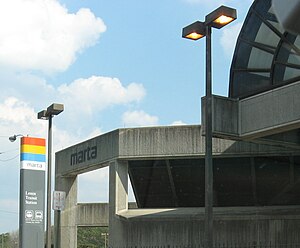
Lenox is an at-grade subway station in Atlanta, Georgia, serving the Gold Line of the Metropolitan Atlanta Rapid Transit Authority. Located in the Buckhead district, it provides access to Lenox Square and Phipps Plaza, which are located on Peachtree Street across the street from one another, as well as the nearby neighborhoods of Lenox Park and Pine Hills. It also provides connecting bus service to Piedmont Park, Atlanta Botanical Garden, and Ansley Mall.
NE7
Lenox
| |||||||||||
|---|---|---|---|---|---|---|---|---|---|---|---|
| MARTA rapid transit station | |||||||||||
 | |||||||||||
| General information | |||||||||||
| Location | 955 East Paces Ferry Road NE Atlanta, Georgia 30326 | ||||||||||
| Coordinates | 33°50′50″N 84°21′23″W / 33.847144°N 84.35631°W | ||||||||||
| Platforms | 1 island platform | ||||||||||
| Tracks | 2 | ||||||||||
| Connections | |||||||||||
| Construction | |||||||||||
| Structure type | Open-cut | ||||||||||
| Parking | 321 spaces | ||||||||||
| Bicycle facilities | No | ||||||||||
| Accessible | Yes | ||||||||||
| Other information | |||||||||||
| Station code | NE7 | ||||||||||
| History | |||||||||||
| Opened | December 15, 1984 | ||||||||||
| Services | |||||||||||
| |||||||||||
| |||||||||||
This is the northernmost Gold Line station in Fulton County. Northeast of the station, the line crosses into DeKalb County.
Station layout
edit| G | Street Level | Entrance/Exit, station house |
| P Platform level |
Westbound | ← Gold Line toward Airport (Lindbergh Center) |
| Island platform, doors will open on the left | ||
| Eastbound | Gold Line toward Doraville (Brookhaven/Oglethorpe) → | |
History
editThe station was built on the site of Johnsontown, a small community of about 30 African American families originally settled in 1912. The properties were acquired in the early 1980s and the houses razed to make way for the station.[1] The station opened in 1984 when the Northeast Line (now Gold) was extended from Arts Center to Brookhaven (now Brookhaven/Oglethorpe).
Initially, the code was N7. But in 1994, it was changed to NE7.
Parking
editLenox has both a parking lot (193 spaces) and parking deck (128 spaces) for MARTA patrons.
Nearby landmarks and popular destinations
editBus routes
editThe station is served by the following MARTA bus routes:
- Route 27 - Cheshire Bridge Road
Connections to other transit systems
editReferences
edit- ^ Keating, Larry (2010). Atlanta: Race, Class and Urban Expansion. Temple University Press. p. 49. ISBN 978-1439904497.
