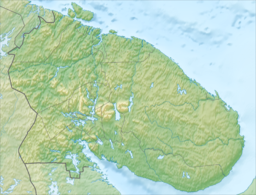
Lake Lovozero (Kildin Sami: Луяввьр, Skolt Sami: Luujäuʹrr, Russian: Ловозеро, Northern Sami: Lujávri, Finnish: Luujärvi) is located on the Kola Peninsula, in Murmansk Oblast within the Barents Sea basin and ensures runoff from the river Voronya. Area: 200 km², average depth is 5.7 metres, maximal 35 m. Annual fluctuations do not exceed 1 m, and the average period of water renewal is about 10 months. The lake has a winding coastline and many peninsulas and islands. The area surrounding the lake, e.g. the Lovozerskiye Tundras is commonly known as "Ловозёрье" in Russian (Lovozerye, Lovozyorye).
| Lake Lovozero | |
|---|---|
 | |
| Location | Kola Peninsula, Murmansk Oblast |
| Coordinates | 67°54′N 35°12′E / 67.900°N 35.200°E |
| Type | natural lake, reservoir |
| Primary inflows | Voronya, Seydyavryok |
| Primary outflows | Voronya |
| Basin countries | Russia |
| Surface area | 200 km2 (77 sq mi) |
| Average depth | 5.7 m (19 ft) |
| Max. depth | 35 m (115 ft) |
| Residence time | 10 months |
In 1970, two hydroelectric power plants were built on the Voronya River at Serebryansk, about 100 kilometers downstream from the lake. The dam at the power plant created a reservoir on the Voronya with the same waterlevel as Lake Lovozero, effectively turning the two bodies of water into one.
One of the most important rare-earth elements deposits of Europe is located in the Lake Lozovero and nearby areas of the Kola Peninsula.[1]
References
edit- ^ "Lovozero (Record #219) rare-earth element deposit in Russia". mrdata.usgs.gov. Retrieved 2023-07-08.

