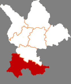
Min County or Minxian is administratively under the control of the prefecture-level city of Dingxi, in the south of Gansu province, China. In ancient times, it was known as Lintao County due to its location along the Tao River. It was founded as Minzhou (岷州) in 544, named after the Min Mountains in the south of the county. The county received its present name in 1913. In 1985 it became subordinate to Dingxi.[2] Min county is well known by Angelica sinensis (Chinese: 当归; pinyin: dāngguī) which is a Chinese traditional medicine.
Min County
岷县 | |
|---|---|
 Minyang town, the county seat of Minxian | |
 Min County in Dingxi | |
 Dingxi in Gansu | |
| Coordinates: 34°26′14″N 104°1′49″E / 34.43722°N 104.03028°E | |
| Country | China |
| Province | Gansu |
| Prefecture-level city | Dingxi |
| County seat | Minyang |
| Area | |
| • County | 3,578 km2 (1,381 sq mi) |
| Population (31-12-2019)[1] | |
| • County | 462,800 |
| • Density | 130/km2 (340/sq mi) |
| • Urban | 124,300 |
| • Rural | 338,500 |
| Time zone | UTC+8 (China Standard) |
| Postal code | 748400 |
| Website | http://minxian.gov.cn/ |
| Min County | |||||||
|---|---|---|---|---|---|---|---|
| Traditional Chinese | 岷縣 | ||||||
| Simplified Chinese | 岷县 | ||||||
| |||||||
Administrative divisions
editMin County is divided to 15 towns and 3 townships.[3]
*County government seat[4]
- Towns
|
|
- Townships
- Qinxu Township(秦许乡)
- Shendu Township(申都乡)
- Suolong Township(锁龙乡)
Climate
edit| Climate data for Minxian, elevation 2,232 m (7,323 ft), (1991–2020 normals, extremes 1981–2010) | |||||||||||||
|---|---|---|---|---|---|---|---|---|---|---|---|---|---|
| Month | Jan | Feb | Mar | Apr | May | Jun | Jul | Aug | Sep | Oct | Nov | Dec | Year |
| Record high °C (°F) | 18.3 (64.9) |
21.8 (71.2) |
27.1 (80.8) |
30.0 (86.0) |
29.3 (84.7) |
29.9 (85.8) |
33.3 (91.9) |
30.5 (86.9) |
29.9 (85.8) |
23.9 (75.0) |
20.2 (68.4) |
15.3 (59.5) |
33.3 (91.9) |
| Mean daily maximum °C (°F) | 3.0 (37.4) |
5.8 (42.4) |
10.2 (50.4) |
15.3 (59.5) |
18.6 (65.5) |
21.3 (70.3) |
23.6 (74.5) |
23.1 (73.6) |
18.7 (65.7) |
13.6 (56.5) |
9.2 (48.6) |
4.5 (40.1) |
13.9 (57.0) |
| Daily mean °C (°F) | −5.7 (21.7) |
−2.1 (28.2) |
2.7 (36.9) |
7.7 (45.9) |
11.5 (52.7) |
14.8 (58.6) |
16.9 (62.4) |
16.3 (61.3) |
12.5 (54.5) |
7.2 (45.0) |
1.4 (34.5) |
−4.4 (24.1) |
6.6 (43.8) |
| Mean daily minimum °C (°F) | −11.7 (10.9) |
−7.5 (18.5) |
−2.6 (27.3) |
1.8 (35.2) |
5.7 (42.3) |
9.3 (48.7) |
11.6 (52.9) |
11.3 (52.3) |
8.2 (46.8) |
3.0 (37.4) |
−3.6 (25.5) |
−10 (14) |
1.3 (34.3) |
| Record low °C (°F) | −24.1 (−11.4) |
−22.8 (−9.0) |
−17.4 (0.7) |
−9.0 (15.8) |
−4.3 (24.3) |
1.1 (34.0) |
1.8 (35.2) |
2.1 (35.8) |
−1.9 (28.6) |
−8.2 (17.2) |
−16.9 (1.6) |
−21.5 (−6.7) |
−24.1 (−11.4) |
| Average precipitation mm (inches) | 3.9 (0.15) |
5.1 (0.20) |
16.2 (0.64) |
40.7 (1.60) |
80.5 (3.17) |
86.4 (3.40) |
105.4 (4.15) |
101.8 (4.01) |
75.9 (2.99) |
46.5 (1.83) |
7.3 (0.29) |
1.5 (0.06) |
571.2 (22.49) |
| Average precipitation days (≥ 0.1 mm) | 4.6 | 5.2 | 8.8 | 11.9 | 15.9 | 15.9 | 14.9 | 14.6 | 15.2 | 13.3 | 4.3 | 2.0 | 126.6 |
| Average snowy days | 8.1 | 9.4 | 10.1 | 4.7 | 0.8 | 0 | 0 | 0 | 0 | 2.5 | 5.1 | 5.3 | 46 |
| Average relative humidity (%) | 57 | 58 | 61 | 61 | 64 | 70 | 74 | 74 | 76 | 74 | 67 | 59 | 66 |
| Mean monthly sunshine hours | 184.2 | 166.1 | 180.2 | 190.8 | 201.4 | 187.1 | 199.2 | 193.8 | 139.4 | 146.5 | 179.3 | 192.7 | 2,160.7 |
| Percent possible sunshine | 58 | 53 | 48 | 48 | 46 | 43 | 46 | 47 | 38 | 42 | 58 | 63 | 49 |
| Source: China Meteorological Administration[5][6] | |||||||||||||
Transport
edit- China National Highway 212
- G75 Lanzhou–Haikou Expressway (under construction)
References
edit- ^ "甘肃省统计年鉴2019" [Gansu Provincial Statistical Yearbook 2019].
- ^ "甘肃省一个县,人口超50万,因为一座山而得名!_岷县". www.sohu.com. Retrieved 2021-01-21.
- ^ "统计用区划代码 www.stats.gov.cn" (in Chinese). XZQH. Retrieved 2020-12-27.
- ^ "岷县人民政府 关于我们". www.minxian.gov.cn. Retrieved 2024-06-18.
- ^ 中国气象数据网 – WeatherBk Data (in Simplified Chinese). China Meteorological Administration. Retrieved 27 August 2023.
- ^ 中国气象数据网 (in Simplified Chinese). China Meteorological Administration. Retrieved 27 August 2023.
Wikimedia Commons has media related to Min County.