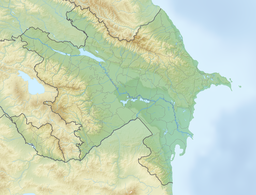
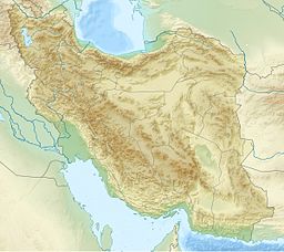
The Giz Galasi Reservoir (Azerbaijani: Qız Qalası su anbarı) is a reservoir on the Aras River, created by the Giz Galasi Dam straddling the international border between Azerbaijan and Iran. The reservoir has a total capacity of 1.6 billion cubic metres (57×109 cu ft).[1] It is located between Jabrayil and Zangilan districts of Azerbaijan and Khoda Afarin County of Iran. It was formed between 1999 and 2008.[2] The reservoir is located 12 km (7.5 mi) below the Khoda Afarin Reservoir. From 1993 to 18 October 2020, the reservoir was under the control of the Republic of Armenia together with the hydroelectric power station of the same name. It is planned to provide 12,000 hectares (30,000 acres) of land with water.[3] Parts of the lake have been declared Important Bird Area.[4]
| Giz Galasi Reservoir | |
|---|---|
| Qız Qalası su anbarı (Azerbaijani) | |
 The reservoir in May 2024 | |
| Location | Khomarlu, East Azerbaijan Province |
| Coordinates | 39°10′09″N 47°01′03″E / 39.16917°N 47.01750°E |
| Type | Reservoir |
| River sources | Aras River |
| Basin countries | Azerbaijan |
| Managing agency | Ministry of Energy |
| First flooded | 2008 |
| Water volume | 1.6 billion cubic metres (57×109 cu ft) |
See also
editReferences
edit- ^ "Xudanın da afərin dediyi layihə necə həyata keçirildi?" (in Azerbaijani). Müsavat. 21 October 2020. Archived from the original on 19 May 2024. Retrieved 19 May 2024.
- ^ "Reducing Transboundary Degradation in the Kura-Ara(k)s River Basin (updated transboundary diagnostic analysis)" (PDF). Tbilisi, Georgia; Baku, Azerbaijan; Yerevan, Armenia. September 2013. Archived (PDF) from the original on 2014-02-26. Retrieved 2021-09-05.
- ^ "İran Qız Qalası su anbarından istifadəyə hazırlaşır". Trend.Az (in Azerbaijani). 2020-11-23. Archived from the original on 2021-09-05. Retrieved 2021-09-05.
- ^ "Arasbaran Protected Area". Archived from the original on 2024-05-20. Retrieved 2024-05-20.

