This article needs additional citations for verification. (March 2017) |
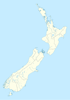
Millbrook Resort is a luxury resort near Queenstown, New Zealand. It is located 4 kilometres to the west of the historic gold-mining town of Arrowtown. The resort covers 650 acres of the Wakatipu Basin - a glacial valley bordered by the Crown Range, The Remarkables and Lake Wakatipu.
| Millbrook Resort | |
|---|---|
| General information | |
| Location | Queenstown, New Zealand |
| Address | 1124 Malaghans Rd, Arrowtown 9371 |
| Coordinates | 44°56′34″S 168°49′05″E / 44.9428038°S 168.8180444°E |
| Website | |
| Official website | |
The resort includes five restaurants, a bar/café, a spa and a 36 hole golf course.
Millbrook is privately owned by the Ishii family, though individual residences within the resort are owned by a diverse group of investors, largely from New Zealand but also from Australia and around the world.

Millbrook Declaration
editIn 1995, Millbrook was the venue for a top-level meeting of Commonwealth heads of government, meeting to design a policy programme of the Commonwealth of Nations, designed to ratify the basic political membership criteria of the Commonwealth. The programme was agreed and announced on 12 November 1995.
Demographics
editMillbrook is described by Statistics New Zealand as a rural settlement. It covers 3.25 km2 (1.25 sq mi)[1] and had an estimated population of 140 as of June 2024,[2] with a population density of 43 people per km2. It is part of the Wakatipu Basin statistical area.[3]
| Year | Pop. | ±% p.a. |
|---|---|---|
| 2006 | 84 | — |
| 2013 | 87 | +0.50% |
| 2018 | 123 | +7.17% |
| Source: [4] | ||
Before the 2023 census, Millbrook had a different boundary, covering 3.29 km2 (1.27 sq mi).[1] Using that boundary, Millbrook had a population of 123 at the 2018 New Zealand census, an increase of 36 people (41.4%) since the 2013 census, and an increase of 39 people (46.4%) since the 2006 census. There were 57 households, comprising 63 males and 63 females, giving a sex ratio of 1.0 males per female, with 12 people (9.8%) aged under 15 years, 9 (7.3%) aged 15 to 29, 57 (46.3%) aged 30 to 64, and 45 (36.6%) aged 65 or older.
Ethnicities were 97.6% European/Pākehā, 4.9% Māori, 2.4% Pasifika, and 2.4% other ethnicities. People may identify with more than one ethnicity.
Although some people chose not to answer the census's question about religious affiliation, 53.7% had no religion, and 46.3% were Christian.
Of those at least 15 years old, 45 (40.5%) people had a bachelor's or higher degree, and 6 (5.4%) people had no formal qualifications. 48 people (43.2%) earned over $70,000 compared to 17.2% nationally. The employment status of those at least 15 was that 39 (35.1%) people were employed full-time, and 21 (18.9%) were part-time.[4]
References
edit- ^ a b "ArcGIS Web Application". statsnz.maps.arcgis.com. Retrieved 16 December 2021.
- ^ "Aotearoa Data Explorer". Statistics New Zealand. Retrieved 26 October 2024.
- ^ 2018 Census place summary: Wakatipu Basin
- ^ a b "Statistical area 1 dataset for 2018 Census". Statistics New Zealand. March 2020. 7028040 and 7028042.
