Mount Edziza Provincial Park
(Redirected from Mount Edziza Provincial Park and Recreation Area)
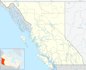
Mount Edziza Provincial Park is a provincial park in Cassiar Land District of northern British Columbia, Canada. It was established on 27 July 1972 to showcase the Mount Edziza volcanic complex and the surrounding Tahltan Highland.
| Mount Edziza Provincial Park | |
|---|---|
 Alpine tundra of Mount Edziza | |
| Location | Cassiar Land District, British Columbia, Canada |
| Coordinates | 57°39′N 130°45′W / 57.650°N 130.750°W |
| Area | 266,180 ha (1,027.7 sq mi) |
| Established | 27 July 1972 |
| Governing body | BC Parks |
| Website | Mount Edziza Provincial Park |
 | |
Geography
editThe park includes the Mount Edziza volcanic complex, a large group of overlapping shield volcanoes, stratovolcanoes, cinder cones, lava domes and calderas oriented in a north−south trending line. It includes Mount Edziza at its northern end and the Spectrum Range at its southern end, both of which are within the boundaries of Mount Edziza Provincial Park.[2][3]
See also
editReferences
edit- ^ "Protected Planet | Mount Edziza Park". Protected Planet. Archived from the original on 2023-01-27. Retrieved 2020-10-10.
- ^ Wood, Charles A.; Kienle, Jürgen (1990). Volcanoes of North America: United States and Canada. Cambridge University Press. pp. 124, 125. ISBN 0-521-43811-X.
- ^ "A 502" (Topographic map). Telegraph Creek, Cassiar Land District, British Columbia (3 ed.). 1:250,000. 104 G (in English and French). Department of Energy, Mines and Resources. 1989. Archived from the original on 2021-05-02. Retrieved 2021-09-25.
External links
edit- "Mount Edziza Park". BC Geographical Names.
- Media related to Mount Edziza Provincial Park at Wikimedia Commons
