[ 3] Name on the Register[ 4]
Image
Date listed[ 5]
Location
City or town
Description
1
Albania Upload image May 13, 1976 (#76001313 ) U.S. 17 W of jct. with NC 32 36°03′37″N 76°37′08″W / 36.060278°N 76.618889°W / 36.060278; -76.618889 (Albania ) Edenton
2
Athol Athol May 22, 1980 (#80002808 ) SE of Edenton on SR 1114 36°00′43″N 76°33′38″W / 36.011944°N 76.560556°W / 36.011944; -76.560556 (Athol ) Edenton
3
Barker House Barker House March 24, 1972 (#72000931 ) S Terminus of Broad St. 36°03′22″N 76°36′34″W / 36.056097°N 76.609344°W / 36.056097; -76.609344 (Barker House ) Edenton
4
Chowan County Courthouse Chowan County Courthouse April 15, 1970 (#70000447 ) E. King St. 36°03′28″N 76°36′30″W / 36.057778°N 76.608333°W / 36.057778; -76.608333 (Chowan County Courthouse ) Edenton
5
Cullins-Baker House Upload image April 29, 1982 (#82003442 ) NC 32 36°17′41″N 76°39′01″W / 36.294722°N 76.650278°W / 36.294722; -76.650278 (Cullins-Baker House ) Smalls Crossroads
6
Cupola House Cupola House April 15, 1970 (#70000889 ) 408 S. Broad St. 36°03′28″N 76°36′38″W / 36.057778°N 76.610556°W / 36.057778; -76.610556 (Cupola House ) Edenton
7
Edenton Cotton Mill Historic District Edenton Cotton Mill Historic District February 5, 1999 (#99000089 ) Bounded by E. Church St., Bount's Creek, Queen Anne's Creek, and Wood Ave. 36°03′37″N 76°36′08″W / 36.060278°N 76.602222°W / 36.060278; -76.602222 (Edenton Cotton Mill Historic District ) Edenton
8
Edenton Historic District Edenton Historic District July 16, 1973 (#73001316 ) Roughly bounded by E. and W. Freemason, S. Oakum, E. and W. Water, and Mosely Sts.; also both sides of the 300 block of E. King St.; also roughly bounded by Filberts Creek, W. Hicks St., Park Ave., the railroad right of way, and the original Edenton Historic District 36°03′35″N 76°36′37″W / 36.059722°N 76.610278°W / 36.059722; -76.610278 (Edenton Historic District ) Edenton Second and third sets of boundaries represent boundary increases of October 5, 2001 and September 28, 2007 respectively
9
Edenton Peanut Factory Upload image September 20, 1979 (#79003328 ) E. Church St. 36°03′37″N 76°36′09″W / 36.060278°N 76.602500°W / 36.060278; -76.602500 (Edenton Peanut Factory ) Edenton
10
Edenton Station, United States Fish and Fisheries Commission Upload image September 14, 2002 (#02000961 ) 200 blk. Old Fish Hatchery Rd. 36°03′21″N 76°37′33″W / 36.055897°N 76.625731°W / 36.055897; -76.625731 (Edenton Station, United States Fish and Fisheries Commission ) Edenton
11
Golden Asro and Ruth Holley Frinks House Upload image August 8, 2023 (#100009229 ) 122 West Peterson St. 36°03′59″N 76°36′31″W / 36.0665°N 76.6087°W / 36.0665; -76.6087 (Golden Asro and Ruth Holley Frinks House ) Edenton
12
Greenfield Plantation Upload image May 6, 1976 (#76001316 ) E of Edenton on SR 1109 36°03′13″N 76°26′33″W / 36.053611°N 76.4425°W / 36.053611; -76.4425 (Greenfield Plantation ) Somer
13
Hayes Plantation Hayes Plantation February 26, 1974 (#74001341 ) E. Water St. Extension 36°03′00″N 76°36′08″W / 36.05°N 76.602222°W / 36.05; -76.602222 (Hayes Plantation ) Edenton
14
Hicks Field Upload image September 13, 1995 (#95001050 ) Jct. of Freemason and Woodard Sts., NE corner 36°03′54″N 76°36′20″W / 36.065°N 76.605556°W / 36.065; -76.605556 (Hicks Field ) Edenton
15
James Iredell House James Iredell House February 26, 1970 (#70000449 ) 107 E. Church St. 36°03′38″N 76°36′25″W / 36.060556°N 76.606944°W / 36.060556; -76.606944 (James Iredell House ) Edenton
16
Cullen and Elizabeth Jones House Cullen and Elizabeth Jones House May 3, 2006 (#06000340 ) 2732 Rocky Hock Rd. 36°10′57″N 76°41′25″W / 36.1825°N 76.690278°W / 36.1825; -76.690278 (Cullen and Elizabeth Jones House ) Edenton
17
Susan J. Armistead Moore House Upload image May 18, 2005 (#05000436 ) NC 32, 0.25 miles W of jct. with NC 37 36°01′50″N 76°32′16″W / 36.030556°N 76.537778°W / 36.030556; -76.537778 (Susan J. Armistead Moore House ) Edenton
18
Mulberry Hill Mulberry Hill May 13, 1976 (#76001314 ) SE of Edenton on SR 1114 36°00′38″N 76°32′11″W / 36.010556°N 76.536389°W / 36.010556; -76.536389 (Mulberry Hill ) Edenton
19
Pembroke Hall Pembroke Hall November 7, 1976 (#76001315 ) W. King St. 36°03′29″N 76°36′41″W / 36.058056°N 76.611389°W / 36.058056; -76.611389 (Pembroke Hall ) Edenton
20
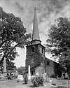
St. Paul's Episcopal Church and Churchyard St. Paul's Episcopal Church and Churchyard May 29, 1975 (#75001248 ) W. Church and Broad Sts. 36°03′42″N 76°36′34″W / 36.061667°N 76.609444°W / 36.061667; -76.609444 (St. Paul's Episcopal Church and Churchyard ) Edenton
21
Sandy Point Sandy Point April 25, 1985 (#85000875 ) Off NC 32 East of NC 1114 36°00′40″N 76°31′15″W / 36.011111°N 76.520833°W / 36.011111; -76.520833 (Sandy Point ) Edenton
22
Shelton Plantation House Upload image October 29, 1974 (#74001342 ) Off NC 32 36°04′56″N 76°37′47″W / 36.082222°N 76.629722°W / 36.082222; -76.629722 (Shelton Plantation House ) Edenton
23
Speight House and Cotton Gin Upload image September 22, 1980 (#80002809 ) E. Church St. 36°03′47″N 76°35′42″W / 36.063056°N 76.595000°W / 36.063056; -76.595000 (Speight House and Cotton Gin ) Edenton
24
Strawberry Hill Strawberry Hill May 22, 1980 (#80002810 ) Church St. 36°03′41″N 76°35′46″W / 36.061389°N 76.596111°W / 36.061389; -76.596111 (Strawberry Hill ) Edenton
25
Wessington House Wessington House March 20, 1973 (#73001317 ) 120 W. King St. 36°03′32″N 76°36′42″W / 36.058889°N 76.611667°W / 36.058889; -76.611667 (Wessington House ) Edenton


