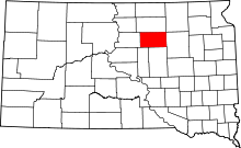
This is a list of the National Register of Historic Places listings in Faulk County, South Dakota .
Location of Faulk County in South Dakota This is intended to be a complete list of the properties on the National Register of Historic Places in Faulk County , South Dakota , United States . The locations of National Register properties for which the latitude and longitude coordinates are included below, may be seen in a map.[ 1]
There are 10 properties listed on the National Register in the county.
This National Park Service list is complete through NPS recent listings posted October 25, 2024. [ 2]
[ 3] Name on the Register[ 4]
Image
Date listed[ 5]
Location
City or town
Description
1
Gov. Frank M. Byrne House Gov. Frank M. Byrne House January 30, 1992 (#91002044 ) 1017 St. John St. 45°01′58″N 99°07′40″W / 45.032778°N 99.127778°W / 45.032778; -99.127778 (Gov. Frank M. Byrne House ) Faulkton
2
Dr. William Edgerton House Upload image November 29, 2010 (#10000951 ) 308 Tenth Ave. S. 45°02′14″N 99°07′38″W / 45.037222°N 99.127222°W / 45.037222; -99.127222 (Dr. William Edgerton House ) Faulkton
3
Faulk County Courthouse Faulk County Courthouse February 10, 1993 (#92001857 ) Junction of 9th Ave. and Court St. 45°02′02″N 99°07′34″W / 45.033889°N 99.126111°W / 45.033889; -99.126111 (Faulk County Courthouse ) Faulkton
4
Faulkton American Legion Hall Faulkton American Legion Hall February 10, 2005 (#05000034 ) 107 8th Ave., N. 45°02′15″N 99°07′26″W / 45.0375°N 99.123889°W / 45.0375; -99.123889 (Faulkton American Legion Hall ) Faulkton
5
C.W. Parker Carousel No. 825 Upload image July 31, 2017 (#100001399 ) 109 9th Ave. S. 45°02′02″N 99°07′32″W / 45.034008°N 99.125451°W / 45.034008; -99.125451 (C.W. Parker Carousel No. 825 ) Faulkton
6
Maj. John A. Pickler Homestead Upload image April 11, 1973 (#73001742 ) Southern edge of the Faulkton city limits 45°01′38″N 99°07′28″W / 45.027222°N 99.124444°W / 45.027222; -99.124444 (Maj. John A. Pickler Homestead ) Faulkton
7
Sievers School Upload image February 25, 2014 (#14000031 ) NE. corner of 362nd Ave. & 170th St. 44°55′34″N 98°56′25″W / 44.926215°N 98.940184°W / 44.926215; -98.940184 (Sievers School ) Rockham
8
South Dakota Dept. of Transportation Bridge No. 25-218-141 Upload image December 9, 1993 (#93001288 ) 10th Ave. over the south fork of Snake Creek 45°02′28″N 99°07′41″W / 45.041044°N 99.128143°W / 45.041044; -99.128143 (South Dakota Dept. of Transportation Bridge No. 25-218-141 ) Faulkton
9
South Dakota Dept. of Transportation Bridge No. 25-380-142 Upload image December 9, 1993 (#93001262 ) Local road over the south fork of Snake Creek 45°02′20″N 98°47′53″W / 45.038889°N 98.798056°W / 45.038889; -98.798056 (South Dakota Dept. of Transportation Bridge No. 25-380-142 ) Zell Replaced in 1997[ 6]
10
Frank and Clara Turner House Frank and Clara Turner House February 13, 1986 (#86000245 ) 1006 Main 45°02′08″N 99°08′00″W / 45.035556°N 99.133333°W / 45.035556; -99.133333 (Frank and Clara Turner House ) Faulkton
^ The latitude and longitude information provided in this table was derived originally from the National Register Information System, which has been found to be fairly accurate for about 99% of listings. Some locations in this table may have been corrected to current GPS standards.
^ National Park Service, United States Department of the Interior , "National Register of Historic Places: Weekly List Actions" , retrieved October 25, 2024.
^ Numbers represent an alphabetical ordering by significant words. Various colorings, defined here , differentiate National Historic Landmarks and historic districts from other NRHP buildings, structures, sites or objects.
^ "National Register Information System" . National Register of Historic Places National Park Service . April 24, 2008.^ The eight-digit number below each date is the number assigned to each location in the National Register Information System database, which can be viewed by clicking the number.
^ https://uglybridges.com/sd/faulk/ [dead link
