This is a list of the National Register of Historic Places listings in Lawrence County, Pennsylvania .
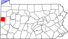
Location of Lawrence County in Pennsylvania This is intended to be a complete list of the properties and districts on National Register of Historic Places in Lawrence County , Pennsylvania , United States . The locations of National Register properties and districts for which the latitude and longitude coordinates are included below, may be seen in a map.[ 1]
There are 10 properties and districts listed on the National Register in the county.
This National Park Service list is complete through NPS recent listings posted October 25, 2024. [ 2]
[ 3] Name on the Register
Image
Date listed[ 4]
Location
City or town
Description
1
Banks Covered Bridge Banks Covered Bridge June 27, 1980 (#80003543 ) Southeast of New Wilmington on Township 476 41°05′26″N 80°17′10″W / 41.090556°N 80.286111°W / 41.090556; -80.286111 (Banks Covered Bridge ) Wilmington Township
2
Lawrence County Courthouse Lawrence County Courthouse December 15, 1978 (#78002419 ) Court Street 40°59′54″N 80°20′22″W / 40.998333°N 80.339444°W / 40.998333; -80.339444 (Lawrence County Courthouse ) New Castle
3
McClelland Homestead McClelland Homestead May 17, 1989 (#89000359 ) McClelland Road northeast of Bessemer 40°59′37″N 80°27′03″W / 40.993611°N 80.450833°W / 40.993611; -80.450833 (McClelland Homestead ) North Beaver Township
4
McConnell's Mill Covered Bridge McConnell's Mill Covered Bridge June 27, 1980 (#80003544 ) North of Portersville and south of Rose Point on Township 415 40°57′10″N 80°10′14″W / 40.952778°N 80.170556°W / 40.952778; -80.170556 (McConnell's Mill Covered Bridge ) Slippery Rock Township
5
New Castle Armory New Castle Armory May 9, 1991 (#91000516 ) 820 Frank Avenue 40°58′45″N 80°19′30″W / 40.979167°N 80.325°W / 40.979167; -80.325 (New Castle Armory ) Shenango Township
6
New Castle Hospital Upload image September 16, 2022 (#100008138 ) 1000 South Mercer Street 40°59′19″N 80°20′42″W / 40.9886°N 80.3450°W / 40.9886; -80.3450 (New Castle Hospital ) New Castle
7
North Hill Historic District North Hill Historic District February 18, 2000 (#00000056 ) Roughly Delaware, Neshannock, Hill Crest and Fairmont Avenues, and Crescent, Falls, Beaver, Jefferson and Mercer Streets 41°00′43″N 80°20′28″W / 41.011944°N 80.341111°W / 41.011944; -80.341111 (North Hill Historic District ) New Castle
8
Old Homestead Old Homestead August 22, 1980 (#80003542 ) Northwest of Enon Valley off Pennsylvania Route 351 40°52′28″N 80°28′17″W / 40.874444°N 80.471389°W / 40.874444; -80.471389 (Old Homestead ) Little Beaver Township
9
S. R. Thompson House S. R. Thompson House March 7, 1985 (#85000467 ) 400 Market Street 41°07′07″N 80°20′01″W / 41.118611°N 80.333611°W / 41.118611; -80.333611 (S. R. Thompson House ) New Wilmington
10
Scottish Rite Cathedral Scottish Rite Cathedral December 30, 2008 (#08001266 ) 110 East Lincoln Avenue 41°00′19″N 80°20′41″W / 41.005278°N 80.344722°W / 41.005278; -80.344722 (Scottish Rite Cathedral ) New Castle
^ The latitude and longitude information provided in this table was derived originally from the National Register Information System, which has been found to be fairly accurate for about 99% of listings. Some locations in this table may have been corrected to current GPS standards.
^ National Park Service, United States Department of the Interior , "National Register of Historic Places: Weekly List Actions" , retrieved October 25, 2024.
^ Numbers represent an alphabetical ordering by significant words. Various colorings, defined here , differentiate National Historic Landmarks and historic districts from other NRHP buildings, structures, sites or objects.
^ The eight-digit number below each date is the number assigned to each location in the National Register Information System database, which can be viewed by clicking the number.
