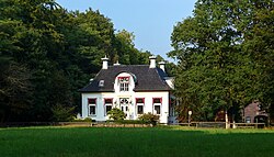
Oosterbroek is a mansion and a former hamlet in the Dutch province of Drenthe. The mansion is located about 2 km east of Eelde, in the municipality of Tynaarlo.
Oosterbroek | |
|---|---|
 Havezate Oosterbroek | |
Location in province of Drenthe in the Netherlands | |
| Coordinates: 53°07′53″N 6°35′34″E / 53.1314°N 6.5928°E | |
| Country | Netherlands |
| Province | Drenthe |
| Municipality | Tynaarlo |
| Area | |
| • Total | 1.77 km2 (0.68 sq mi) |
| Elevation | 3 m (10 ft) |
| Population (2021)[1] | |
| • Total | 165 |
| • Density | 93/km2 (240/sq mi) |
| Time zone | UTC+1 (CET) |
| • Summer (DST) | UTC+2 (CEST) |
| Postal code | 9761[1] |
| Dialing code | 050 |
The hamlet was located around the mansion. The mansion was a havezate which was a requirement to be admitted to the Knights of Drenthe.[3] Around 1850, it had 3 houses and about 25 inhabitants.[4] It was still considered to be a separate settlement in 1997,[5] but the name no longer appears on the newest topographical maps.[6] As of 2021, it is a statistical entity with Groningen Airport Eelde,[1] however the postal authorities have put it under Eelde.[7]
Gallery
edit-
Mansion Hoog Hullen
-
Bridge over the canal
-
Horses near Oosterbroek
References
edit- ^ a b c d "Kerncijfers wijken en buurten 2021". Central Bureau of Statistics. Retrieved 13 March 2022.
Joint listing with Groningen Airport Eelde
- ^ "Postcodetool for 9761AA". Actueel Hoogtebestand Nederland (in Dutch). Het Waterschapshuis. Retrieved 13 March 2022.
- ^ "Havezate". Geheugen van Drenthe (in Dutch). Retrieved 13 March 2022.
- ^ Abraham Jacob van der Aa, "Aardrijkskundig woordenboek der Nederlanden", vol. 8 (N/O), 1846.
- ^ "VUGA's Alfabetische Plaatsnamengids van Nederland", 13th edition, 1997.
- ^ ANWB Topografische Atlas Nederland, Topografische Dienst and ANWB, 2005.
- ^ "Postcode 9761 in Eelde". Postcode bij adres (in Dutch). Retrieved 13 March 2022.
Wikimedia Commons has media related to Oosterbroek, Drenthe.

