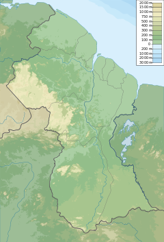
The Pomeroon River (also Río Pomerón[1][2] or Pomaron[3]) is located in Guyana, South America, situated between the Orinoco and the Essequibo rivers. The area has long been inhabited by Lokono people. The Pomeroon River is also one of the deepest rivers in Guyana.
| Pomeroon River | |
|---|---|
 | |
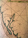
 Old Map of Pomeroon River (1688) | |
| Location | |
| Country | Guyana Claimed by |
| Physical characteristics | |
| Mouth | Atlantic Ocean |
• coordinates | 7°37′N 58°45′W / 7.617°N 58.750°W |
• elevation | Sea level |
Pomeroon is within the Guyana coastal plain and the area is populated with mangrove swamp vegetation. Siriki Creek is an estuary of the Pomeroon River.[4] The mouth of the river has been deflected from pouring straight into the Atlantic ocean by a sandy spit that redirects the river to the northwest via the Cozier Canal.[5]
History
editAccording to the London Encyclopaedia of 1829,[3] this river was once regarded as the western boundary between the Demerara and Essequibo Colony[3] and Spanish Guiana.[3]
Use
editCoconuts are a major agricultural product in the Pomeroon area, grown for their water and copra.[6]
Tapakuma is a tributary of the Pomeroon River that was developed into a water conservancy which greatly improved cultivation of rice.[7]
Settlement
editShell mounds associated with early human burials dated to the pre-ceramic Alaka phase have been unearthed in the area.[4]
In 1581, the Dutch founded a colony on the banks of the river. The settlement was destroyed by Arawak People in alliance with Spaniards in 1596. In 1658, lured by the Dutch advertisement to colonize the Essequibo, a Jewish colony settled within the Dutch lands on the Pomeroon. Their plantations were destroyed when the British of Barbados invaded in 1665 and most moved on to Suriname.[8]
An Anglican mission was established in 1840 by W. H. Brett.[9] In Brett's travelogue, the eastern bank of the mouth of the Pomeroon was called Cape Nassau, and the river's source was in the Imataka Mountains. The largest tributary was the Arapaiaco River, located 43 miles from the sea. Bouruma was another name for the river. He observed various Amerindian tribes settled along the river, including Warao and Arawak, as well as former plantation slaves.[10]
Settlements on the Pomeroon include the town of Charity, and Kabakaburi (an Amerindian mission settlement founded by Brett, located 16 miles up from Charity[11]).
See also
editReferences
edit- ^ Solana, Ana Crespo (2006). América desde otra frontera: la Guayana holandesa (Surinam) : 1680-1795 (in Spanish). Editorial CSIC - CSIC Press. ISBN 9788400084486.
- ^ Ríos, Manuel Alberto Donis (1987). Evolución histórica de la cartografía en Guayana y su significación en los derechos venezolanos sobre el Esequibo (in Spanish). Academia Nacional de la Historia. ISBN 9789802221097.
- ^ a b c d The London Encyclopaedia: Or Universal Dictionary of Science, Art, Literature, and Practical Mechanics, Comprising a Popular View of the Present State of Knowledge. Thomas Tegg. 1829.
- ^ a b Plew, Mark G.; Daggers, Louisa B. "Recent excavations at the Siriki shell mound, north-western Guyana". Retrieved 2021-01-21.
- ^ Bird, Eric (2010-02-25). Encyclopedia of the World's Coastal Landforms. Springer Science & Business Media. pp. 245–246. ISBN 978-1-4020-8638-0.
- ^ Coconut genetic resources. Rao, V. Ramanatha., Oliver, Jeffrey., Batugal, Pons. Serdang, Malaysia: International Plant Genetic Resources Institute. 2005. ISBN 92-9043-629-8. OCLC 225109689.
{{cite book}}: CS1 maint: others (link) - ^ Strachan, A. J. (1980). "Water Control in Guyana". Geography. 65 (4): 301. ISSN 0016-7487. JSTOR 40570303.
- ^ Oppenheim, Samuel (1907). "An Early Jewish Colony Western Guiana, 1658-1666 : And ITS Relation to the Jews in Surinam, Cayenne and Tobago". Publications of the American Jewish Historical Society (16): 95–186. ISSN 0146-5511. JSTOR 43059606.
- ^ Whitehead, Neil L.; Alem‡n, Stephanie W. (2009). Anthropologies of Guayana: Cultural Spaces in Northeastern Amazonia. University of Arizona Press. p. 127. ISBN 978-0-8165-2607-9.
- ^ BRETT, REV W. H. (1868). THE INDIAN TRIBES OF GUIANA. pp. 70–71, 79.
- ^ McDougall, Russell; Davidson, Iain (2016-06-03). The Roth Family, Anthropology, and Colonial Administration. Routledge. ISBN 978-1-315-41728-8.
