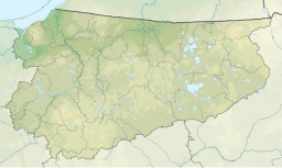
Lake Roś (Polish: Jezioro Roś, German: Roschsee) is a lake in the Masurian Lake District of the Warmian-Masurian Voivodeship of Poland. This S-shaped glacial lake has an area of 18.88 km2 (7.29 sq mi) and a maximum depth of 31.8 metres (104 feet).[2] The Swięcek and Konopka rivers flow into the lake, while the Pisa River flows out of it. The largest town on the lake is Pisz.
| Lake Roś | |
|---|---|
| Jezioro Roś (Polish) | |
 sunset | |
| Location | Masurian Lake District, Poland |
| Coordinates | 53°40′1″N 21°53′36″E / 53.66694°N 21.89333°E |
| Primary inflows | Swięcek and Konopka |
| Primary outflows | Pisa |
| Basin countries | Poland |
| Surface area | 18.88 km2 (7.29 sq mi) |
| Average depth | 8.1 m (27 ft) (mean) |
| Max. depth | 31.8 m (104 ft) |
| Water volume | 152.9×10⁶ m3 (5.40×10⁹ cu ft) |
| Shore length1 | 51.6 km (32.1 mi) |
| Surface elevation | 115.4 m (379 ft) |
| Frozen | For period 1977–1992 usually between 21 December and 15 March with maximum ice thickness 32 cm (13 in) |
| References | [1][2] |
| 1 Shore length is not a well-defined measure. | |
References
edit- ^ Ptak et al. 2024, Materials and Methods 2.1. Materials.
- ^ a b Ptak et al. 2024, Table S1.
Sources
edit- Ptak, M; Amnuaylojaroen, T; Huang, W; Wang, L; Sojka, M (2024). "Role of Lake Morphometric and Environmental Drivers of Ice Cover Formation and Occurrence on Temperate Lakes: A Case Study from the Eastern Baltic Lakeland, Poland". Resources. 13 (10): 146. doi:10.3390/resources13100146.
