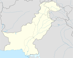
Taunsa District (Balochi,Saraiki, تونسہ دمگ ) is a district in the Punjab province of Pakistan. It is a newly created district in 2022.[2] It is situated on the bank of River Indus. Taunsa is an agricultural area known for its fertile land and crops. The eastern part of district consists of fertile planes irrigated by River Indus and its canal systems, while the western half comprises mountains of Koh e Sulaiman range.
Taunsa District ضِلع تونسا,تونسہ دمگ | |
|---|---|
 | |
| Coordinates: 30°42′20″N 70°39′28″E / 30.70556°N 70.65778°E | |
| Country | |
| Province | |
| Division | Dera Ghazi Khan |
| Union councils | 13 |
| Headquarters | Taunsa |
| Government | |
| • Type | District Administration |
| • Deputy Commissioner | N/A |
| • District Police Officer | N/A |
| • District Health Officer | N/A |
| Area | |
| • Total | 2,769 km2 (1,069 sq mi) |
| Population | |
| • Total | 1,045,460 |
| • Density | 380/km2 (980/sq mi) |
| Time zone | UTC+5 (PST) |
| • Summer (DST) | UTC+6 (PDT) |
| Post code | 32100 |
| Number of Tehsils | 3 |
History
editRegion around Taunsa district was an ancient settlement and remained a village or town earlier to 21st century. Taunsa was part of Multan region inhabited by mostly Baloch people. The region was conquered by Arab Umayyads in 8th century CE spreading Islam in the region. After Baloch Civil War in 14th century Baloch tribes settled in waves in Taunsa and adjoining mountain range.Taunsa sharif was part of the Khanate of Kalat from 1717 to 1795, and later controlled by Afghans before being surrendered to Sikh Empire in 1819.Sakhani (a baloch tribe was ruler,who pledged allegiance to the Maharaja, before arrival of British rule which made them semi autonomous as part of British divide and rule policy.
Demography
editAt the time of the 2023 census, 67.27% of the population spoke Saraiki and 31.18% Balochi as their first language. [3]
Administration
editThe district is administratively subdivided into four tehsils.
| Name of Tehsil | No of Union Councils |
|---|---|
| Koh Sulaiman | |
| Taunsa | |
| Vehowa |
References
edit- ^ "Pakistan: Tehsils and Talukas (Districts and Subdistricts) - Population Statistics, Charts and Map".
- ^ Tehsils & Unions in the District of D.G. Khan - Government of Pakistan Archived 2012-02-09 at the Wayback Machine
- ^ [https:// dgkhan.gop.pk./sites/default/files/population/2023/tables/Punjab/dcr/table_11.pdf "Population by Mother Tongue, Sex and Rural/Urban, Census-2023"] (PDF). Pakistan Bureau of Statistics.
{{cite web}}: Check|url=value (help)
