Side by side comparison
{{Infobox protected area}}{{Infobox protected area/sandbox}}
Aleutian World War II National Historic Area
Map showing the location of Aleutian World War II National Historic Area
LocationUnalaska, Alaska
Nearest cityAnchorage, Alaska
Coordinates53°53′20″N 166°31′38″W / 53.88889°N 166.52722°W / 53.88889; -166.52722
DesignationNational Park Service affiliated area
AuthorizedNovember 12, 1996
OwnerOunalashka Corporation
Side by side comparison
{{Infobox protected area}}{{Infobox protected area/sandbox}}
Ocmulgee National Monument
IUCN category V (protected landscape/seascape)
Great Temple Mound
Map
Location1207 Emery Highway Macon, Georgia, USA
Coordinates32°50′12″N 83°36′30″W / 32.83667°N 83.60833°W / 32.83667; -83.60833
Area701.54 acres (283.90 ha)
EstablishedDecember 23, 1936
Visitors130,281 (in 2005)
Governing bodyNational Park Service

Yosemite

edit
Side by side comparison
{{Infobox protected area}}{{Infobox protected area/sandbox}}
Yosemite National Park
Yosemite is in the far western U.S., a bit east of the center of California.
Yosemite
Location of Yosemite National Park in California
Yosemite is in the far western U.S., a bit east of the center of California.
Yosemite
Location of Yosemite National Park in the United States
LocationTuolumne, Mariposa, & Madera Counties, California, USA
Nearest cityMariposa, California
Coordinates37°51′00″N 119°34′04″W / 37.8499232°N 119.5676663°W / 37.8499232; -119.5676663
Area761,266 acres (3,080.73 km2)
EstablishedOctober 1, 1890
DisestablishedNovember 18, 2290
Visitors3,901,408 (in 2010)[1]
Governing bodyNational Park Service
World Heritage site1984

Upper and Lower Table Rock

edit
Side by side comparison
{{Infobox protected area}}{{Infobox protected area/sandbox}}
Upper and Lower Table Rock
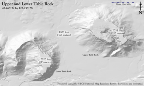
A flat plain with two mesas. The northeast mesa has a small declivity, the southeast a much larger one.
Terrain of the Table Rocks. Upper Table Rock is on the right, Lower Table Rock on the left
Located in southwest Oregon, in a county adjacent to California and two counties away from the Pacific
Location in Oregon, in the United States
LocationJackson County, Oregon
Nearest cityCentral Point, Oregon
Coordinates42°27′54″N 122°56′06″W / 42.465°N 122.935°W / 42.465; -122.935
Governing bodyBureau of Land Management and The Nature Conservancy
www.blm.gov/or/resources/recreation/tablerock/index.php

Dry Island Buffalo Jump Provincial Park

edit
Side by side comparison
{{Infobox protected area}}{{Infobox protected area/sandbox}}
Dry Island Buffalo Jump Provincial Park
A green valley with a river and a road running somewhat parallel to the river
Panoramic view
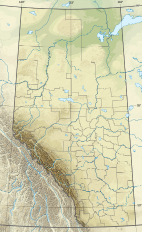
Located in south central Alberta, which is one province away from the west coast of Canada
Location of Dry Island Park in Canada
LocationCanada
Nearest cityThree Hills, Red Deer
Coordinates51°56′10″N 112°57′41″W / 51.93611°N 112.96139°W / 51.93611; -112.96139
Area34.5 km2 (13.3 sq mi)
EstablishedDecember 15, 1970
Governing bodyAlberta Tourism, Parks and Recreation

Ellis Island

edit
Side by side comparison
{{Infobox protected area}}{{Infobox protected area/sandbox}}
Ellis Island
Part of Statue of Liberty National Monument
A large three-story brick-red building whose windows are outlined in white. It has four towers, each with a cupola and spikes at the top.
Ellis Island
LocationJersey City & New York City
Coordinates40°41′56.5″N 74°2′22.2″W / 40.699028°N 74.039500°W / 40.699028; -74.039500
Area58.38 acres (0.24 km2) (includes Statue of Liberty NM)
EstablishedMay 11, 1965 (as a national monument)
Visitors3,618,054 (includes Statue of Liberty NM) (in 2004)[2]
Governing bodyNational Park Service
www.nps.gov/elis/
Ellis Island
Part of Statue of Liberty National Monument
A large three-story brick-red building whose windows are outlined in white. It has four towers, each with a cupola and spikes at the top.
Ellis Island
LocationJersey City & New York City
Coordinates40°41′56.5″N 74°2′22.2″W / 40.699028°N 74.039500°W / 40.699028; -74.039500
Area58.38 acres (0.24 km2) (includes Statue of Liberty NM)
EstablishedMay 11, 1965 (as a national monument)
Visitors3,618,054 (includes Statue of Liberty NM) (in 2004)[2]
Governing bodyNational Park Service
www.nps.gov/elis/

Ala Kahakai National Historic Trail

edit

Uses |length_mi=, |label=, |label_position=

Side by side comparison
{{Infobox protected area}}{{Infobox protected area/sandbox}}
Ala Kahakai National Historic Trail
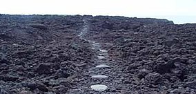
Restored section of the trail
Map showing the location of Ala Kahakai National Historic Trail
Ala Kahakai
Map of the United States
LocationHawaii, US
Nearest cityKailua, Hawaii County, Hawaii
Coordinates18°54′40″N 155°40′52″W / 18.9111111°N 155.6811111°W / 18.9111111; -155.6811111[3]
Length175 mi (282 km)
Established2000
Governing bodyNational Park Service
WebsiteAla Kahakai National Historic Trail

Alerce Costero National Park

edit

Large aspect ratio map (of Chile) should look reasonable

Side by side comparison
{{Infobox protected area}}{{Infobox protected area/sandbox}}
Alerce Costero National Park
Map showing the location of Alerce Costero National Park
LocationLa Unión, Chile commune, Los Ríos Region, Chile
Nearest cityLa Unión, Chile
Coordinates40°11′0″S 73°28′0″W / 40.18333°S 73.46667°W / -40.18333; -73.46667
Area24,000 ha
Established1987, it change its status in 2012 to National Reserve[4]
Governing bodyCorporación Nacional Forestal


Battle Ground Lake State Park

edit
Side by side comparison
{{Infobox protected area}}{{Infobox protected area/sandbox}}
Battle Ground Lake State Park
Map showing the location of Battle Ground Lake State Park
Location in the state of Washington
Map showing the location of Battle Ground Lake State Park
Infobox protected area/testcases (the United States)
LocationClark County, Washington, United States
Nearest cityBattle Ground, Washington
Coordinates45°48′19″N 122°29′37″W / 45.80528°N 122.49361°W / 45.80528; -122.49361[5]
Area275 acres (111 ha)
Elevation509 ft (155 m)[5]
DesignationWashington state park
Established1966
AdministratorWashington State Parks and Recreation Commission
WebsiteBattle Ground Lake State Park
Aerial view of the lake and park
LocationClark County, Washington
Formed byMagma induced steam explosion
GeologyMaar
Surface elevation509 feet (155 m)[6]
Volcanic fieldBoring Lava Field

Jaragua National Park

edit
Side by side comparison
{{Infobox protected area}}{{Infobox protected area/sandbox}}
Jaragua National Park
A flock of American flamingos (Phoenicopterus ruber).
Map
Coordinates17°47′21″N 71°29′56″W / 17.789228°N 71.499023°W / 17.789228; -71.499023
Area1,374 km2 (531 sq mi)
DesignationReserve
Jaragua National Park
A flock of American flamingos (Phoenicopterus ruber).
Map
Coordinates17°47′21″N 71°29′56″W / 17.789228°N 71.499023°W / 17.789228; -71.499023
Area1,374 km2 (531 sq mi)
DesignationReserve

Reference test

edit
  1. ^ "NPS Annual Recreation Visits Report". National Park Service.
  2. ^ test
  3. ^ "Ala Kahakai National Historic Trail". Geographic Names Information System. United States Geological Survey, United States Department of the Interior. Retrieved 2012-04-03.
  4. ^ Alerce costero National Park CONAF Chile, retrieved February, 2014
  5. ^ a b "Battle Ground State Park". Geographic Names Information System. United States Geological Survey, United States Department of the Interior.
  6. ^ "Battle Ground Lake". Geographic Names Information System. United States Geological Survey, United States Department of the Interior.