| This template uses Lua: |
Usage
edit| {{{name}}} | |
|---|---|
| {{{native_name}}} | |
| [[File:{{{image}}}|frameless|alt={{{alt}}}|upright={{{image_upright}}}]] {{{caption}}} | |
| 0°N 0°E / 0°N 0°E | |
| Waterway | {{{waterway}}} |
| Country | {{{country}}} |
| Province | {{{province}}} |
| State | {{{state}}} |
| County | {{{county}}} |
| Maintained by | {{{maint}}} |
| Operation | {{{operation}}} |
| First built | {{{first}}} |
| Latest built | {{{latest}}} |
| Length | {{{length}}} |
| Width | {{{width}}} |
| Fall | {{{fall}}} |
| Above sea level | {{{sealevel}}} |
| Distance to {{{enda}}} | {{{distenda}}} |
| Distance to {{{endb}}} | {{{distendb}}} |
| Heritage status | {{{heritage}}} |
| {{{extra}}} | |
Copy and paste the template below:
{{Infobox waterlock
| name                =
| native_name         =
| image               =
| image_upright       =
| alt                 =
| caption             =
| waterway            =
| country             =
| province            =
| state               =
| county              =
| maint               =
| operation           =
| first               =
| latest              =
| length              =
| width               =
| fall                =
| sealevel            =
| enda                =
| distenda            =
| endb                =
| distendb            =
| heritage            =
| map_image           =
| map_size            =
| map_alt             =
| map_caption         =
| pushpin_map         =
| pushpin_map_size    =
| pushpin_map_alt     =
| pushpin_map_caption =
| coordinates         =
| extra               =
}}
Parameter descriptions
edit- name
- Name of lock
- native_name
- image
- Filename of image
- image_upright
- alt
- alternative text for the image
- caption
- Text for caption beneath image
- waterway
- Waterway on which the lock is situated
- country
- Country
- province
- state
- State or province
- county
- Location of lock
- maint
- Maintaining Entity
- operation
- Type of operation - e.g. manual or hydraulic
- first
- Date when lock was originally built
- latest
- Date of latest reconstruction of lock
- length
- Length of lock with units
- width
- Width of the lock with units
- fall
- Depth of fall of water in the lock with units
- sealevel
- Height of top water level above sea level
- enda
- One relevant end point of waterway
- distenda
- distance to above
- endb
- the other relevant end point of waterway
- distendb
- distance to above
- heritage
- Heritage status
- map_image
- Filename of map image
- map_size
- Map width in a standard value (pixels, for example)
- map_alt
- alternative text for the map image
- map_caption
- Caption beneath map image
- pushpin_map
- pushpin_map_size
- pushpin_map_alt
- pushpin_map_caption
- coordinates
- Latitude and longitude using {{coord}} with display:inline,title.
- extras
- free form, spans both columns, use sparingly
Example
edit| Teddington Lock | |
|---|---|
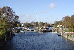
 Teddington Lock undergoing maintenance. From left to right – rollers, skiff lock, launch lock and barge lock | |
 | |
| 51°25′54″N 0°19′26″W / 51.43167°N 0.32389°W | |
| Waterway | River Thames |
| Country | England |
| County | Greater London |
| Maintained by | Environment Agency |
| Operation |
|
| First built |
|
| Length |
|
| Width |
|
| Fall | 2.68 m (8 ft 10 in) |
| Above sea level | 14 ft (4.3 m) |
| Teddington is normally staffed 24 hours a day | |
{{Infobox waterlock
| name                = Teddington Lock
| image               = TeddLock.JPG
| image_upright       = 1.1
| caption             = Teddington Lock undergoing maintenance. From left to right – rollers, skiff lock, launch lock and barge lock
| waterway            = [[River Thames]]
| country             = England
| county              = [[Greater London]]
| maint               = [[Environment Agency]]
| operation           = {{unbulleted list
  | Launch: Hydraulic
  | Skiff:  Manual
  | Barge:  Hydraulic
  }}
| first               = {{unbulleted list
  | Launch: 1811
  | Skiff:  1858
  | Barge:  1904
  }}
| length              = {{unbulleted list
  | Launch: {{convert|54.22|m|ftin|abbr=on}}
  | Skiff:  {{convert|15.08|m|ftin|abbr=on}}
  | Barge:  {{convert|198.12|m|ftin|abbr=on}}
  }}
| width               = {{unbulleted list
  | Launch: {{convert|7.41|m|ftin|abbr=on}}
  | Skiff:  {{convert|1.77|m|ftin|abbr=on}}
  | Barge:  {{convert|7.54|m|ftin|abbr=on}}
  }}
| fall                = {{convert|2.68|m|ftin|abbr=on}}
| sealevel            = {{convert|14|ft|m|abbr=on}}
| pushpin_map         = United Kingdom Greater London
| pushpin_map_size    = 242 <!-- 220 x 1.1 -->
| pushpin_map_caption = Location of Teddington Lock in Greater London
| coordinates         = {{Coord|51|25|54|N|0|19|26|W|type:landmark_region:GB|display=inline,title}}
| extra               = Teddington is normally staffed 24 hours a day
}}