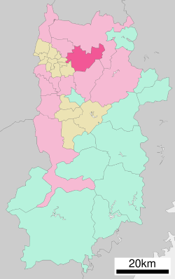
Tenri (天理市, Tenri-shi) is a city located in Nara Prefecture, Japan. As of 30 September 2024[update], the city had an estimated population of 60,890 in 29456 households, and a population density of 700 persons per km2.[1] The total area of the city is 86.42 km2 (33.37 sq mi).[2] The city is named after the Japanese new religion Tenrikyo, which has its headquarters in the city.
Tenri
天理市 | |
|---|---|
 Top left: View of Headquarter in Tenri religious community, Top right: Tenri religious school, Middle left: View of a point of side of mount Miwa road, Middle right: Stone site in Ryuo Mount Castle, Bottom: Tenri Reference Museum | |
 Location of Tenri in Nara Prefecture | |
 | |
| Coordinates: 34°35′48″N 135°50′14″E / 34.59667°N 135.83722°E | |
| Country | Japan |
| Region | Kansai |
| Prefecture | Nara |
| Government | |
| • Mayor | Keisaku Minami |
| Area | |
• Total | 86.42 km2 (33.37 sq mi) |
| Population (September 30, 2024) | |
• Total | 60,890 |
| • Density | 700/km2 (1,800/sq mi) |
| Time zone | UTC+09:00 (JST) |
| City hall address | 605 Kawaharajō-chō, Tenri-shi, Nara-ken |
| Website | Official website |
| Symbols | |
| Flower | Ume |
| Tree | Ginkgo |

Geography
editTenri is located in the north-central part of Nara Prefecture.
Neighboring municipalities
editClimate
editTenri has a humid subtropical climate (Köppen Cfa) characterized by warm summers and cool winters with light to no snowfall. The average annual temperature in Tenri is 13.4 °C. The average annual rainfall is 1636 mm with September as the wettest month. The temperatures are highest on average in August, at around 25.4 °C, and lowest in January, at around 1.9 °C.[3]
Demographics
editPer Japanese census data, the population of Tenri is as shown below
| Year | Pop. | ±% |
|---|---|---|
| 1960 | 50,438 | — |
| 1970 | 57,020 | +13.0% |
| 1980 | 64,894 | +13.8% |
| 1990 | 68,815 | +6.0% |
| 2000 | 72,741 | +5.7% |
| 2010 | 69,178 | −4.9% |
| 2020 | 63,889 | −7.6% |
History
editThe area of Tenri is part of ancient Yamato Province. Tenri was briefly the capital of Japan during the reign of Emperor Ninken.[4] The life of the Imperial court was centered at Isonokami Hirotaka Palace where the emperor lived in 488–498.[5]
The village of Yamanobe was established on April 1, 1889 with the creation of the modern municipalities system. It was raised to town status on September 26, 1893 and renamed Tambaichi (丹波市町). On April 1, 1954, Tambaichi merged with the villages of Asawa, Fukuzumi, and Nikaido and the towns of Ichinomoto and Yanagimoto to form the city of Tenri.
Relations with Tenrikyo
editAbout a quarter of the city's residents are believed to be affiliated with the Tenrikyo religion, and the remaining residents are thought to include several thousand Tenrikyo students. Since almost half of the city area is occupied by non-taxable religious facilities related to Tenrikyo, the city has faced a problem of reduced revenue from property taxes, etc., and to compensate for this, the sect has been making large donations to Tenri City since 1967. The amount of the donation is close to the total local tax revenue of Tenri City. The amount of the donation is decided in consultation between Tenri City and the sect when the annual budget is compiled, depending on the content of the city planning projects for that year. In addition, donations tend to increase sharply in years close to the Tenrikyo Founder's Festival, which is held every 10 years. Thus, Tenri City cannot survive as a municipality without a relationship with the sect, and while the city emphasizes its development as a city integrated with the sect, Tenrikyo headquarters has a policy of not fielding candidates in mayoral and city council elections.
Government
editTenri has a mayor-council form of government with a directly elected mayor and a unicameral city council of 16 members. Tenri contributes two members to the Nara Prefectural Assembly. In terms of national politics, the city is part of the Nara 2nd district of the lower house of the Diet of Japan.
Economy
editThere are many Tenrikyo-related facilities in the city center, giving it the appearance of a religious city, but the city as a whole is an agricultural area. Strawberry cultivation is particularly popular. Industrial activities center on semiconductors and light manufacturing. Due to its location on major east-west highways, the city is increasing becoming a commuter town for the great Osaka metropolis.
Education
editTenri has nine public elementary schools and five public junior high schools operated by the city government and two public high schools operated by the Nara Prefectural Board of Education. There is also one private elementary school junior high schools and one private high school.
Tenri University and Tenri Health Care University, both private universities are located in the city.
Transportation
editRailways
editJR West - Sakurai Line (Manyō-Mahoroba Line)
- U Ichinomoto - Tenri - Nagara - Yanagimoto
Highways
editSister city relations
edit- Bauru, Brazil, since April 1940
- La Serena, Chile, since October 1966
- Seosan, South Korea, since November 1991
Local attractions
editShrines and temples
editTenrikyo
editNational Historic Sites
editNotable people from Tenri
edit- So Yamamura, actor and director
References
edit- ^ "Tenri City official statistics" (in Japanese). Japan.
- ^ "第1章 天理市の概要" (PDF) (in Japanese). Japan: Tenri City. Retrieved 23 October 2024.
- ^ Tenri climate: Average Temperature, weather by month
- ^ Ponsonby-Fane. (1915). The Imperial Family of Japan, p. 15.
- ^ Koch, W. (1904). Japan; Geschichte nach japanischen Quellen und ethnographische Skizzen. Mit einem Stammbaum des Kaisers von Japan, p. 13.
External links
edit- Media related to Tenri, Nara at Wikimedia Commons
- Geographic data related to Tenri, Nara at OpenStreetMap
- Tenri City official website (in Japanese)


