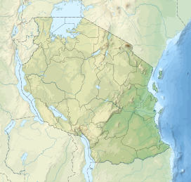
The Umalila Mountains are a mountain range in southern Tanzania, on the border with Malawi. The Umalila Mountains are part of Tanzania's Southern Highlands.
| Umalila Mountains | |
|---|---|
| Geography | |
| Country | Tanzania |
| Range coordinates | 09°18′43″S 33°26′42″E / 9.31194°S 33.44500°E[1] |
| Parent range | Southern Highlands |
| Borders on | Poroto Mountains |
The mountains are named for the Malila people.[2]
Geography
editThe Umalila Mountains lie northwest of Lake Malawi, and trend roughly northwest-southeast. They form part of the western edge of the East African Rift. The Kyela Plain lies to the east and northeast of the mountains in the rift valley.[3] The volcanic Poroto Mountains and Mount Rungwe lie to the northeast across the Kiwira River. The town of Mbeya lies to the north, and plateaus to the west.
The Songwe River drains the western and southern slopes of the mountains, and separate the Umalila Mountains from the Misuku Hills in neighboring Malawi. The Kiwira River drains the eastern slopes. Both rivers empty into Lake Malawi.
Climate
editThe mountains have a tropical montane climate. Rainfall is mostly during the November through April wet season, although higher elevations experience mists and light rain during the May through August dry season. The highlands are cooler than the surrounding lowlands, with annual temperatures between 13°C and 19°C.[4] The Umalila Mountains are drier than Mount Rungwe and the Poroto Mountains to the northeast.[5]
Ecology
editThe natural vegetation at lower elevations is miombo woodland, which extends up to 2,000 ft (610 m). Higher elevations are home to montane grasslands and patches of montane evergreen forest, part of the Southern Rift montane forest-grassland mosaic ecoregion.[4] The mountains are extensively cultivated, and little natural forest remains.[5]
Protected areas
editForest reserves include the Umalila Catchment Forest Reserve (CFR) (3,796 ha), Mpara CFR (1,048 ha), Kyosa Local Authority Forest Reserve (LA-FR) (957 ha), Msimwa LA-FR (727 ha), and Iyondo LA-FR (973 ha).[5]
References
edit- ^ "Map: Umalila Mountains". dataazone.birdlife.org. BirdLife International. Retrieved 2019-12-08.
- ^ Walsh, M. T. (April 1998). "The Malila: Preliminary Notes on Language, History and Ethnography". www.scribd.com. Retrieved 2019-12-08. Unpublished paper, first draft.
- ^ Racaud, Sylvain, and Francois Bart (2017). "Rural-Urban Dynamics in the East African Mountains" Mkuki na Nyota Publishers, 2017
- ^ a b "Southern Rift montane forest-grassland mosaic". World Wildlife Fund ecoregion profile. Retrieved 2010-09-04.
- ^ a b c "Important Bird Areas factsheet: Umalila Mountains". www.birdlife.org. BirdLife International. 2019. Retrieved 2019-09-05.
